Agalega Islands (Agalega Islands)
A 2015 memorandum of understanding on India–Mauritius military cooperation envisages developing the Agaléga islands and allowing an Indian military base. Local residents oppose construction of the base as a threat to local employment and culture and Mauritian sovereignty.
There are three different explanations for the name Agaléga. One hypothesis is that the Portuguese explorer, Dom Pedro Mascarenhas, named Agaléga and the island of Sainte Marie (off the east coast of Madagascar) in honor of his two sailboats, the "Galega" and the "Santa Maria" in 1512, when he discovered Mauritius and Réunion Island.
Another, more probable explanation relates to the Galician explorer João da Nova, who discovered the islands in 1501 while working for the Portuguese. João was popularly known by his sailors as João Galego, according to Jean-Baptiste Benoît Eyriès' Les Nouvelles Annales de Voyage (Volume 38, page 88). Galego is the Galician/Portuguese word for someone from Galicia, North West Spain, and "Agalega", is derived from the feminine version of this (a is the feminine article in Galician/Portuguese, and Galician illa for "island" is feminine, so a [illa] galega would mean "the Galician [Island]").
A further idea comes from a story in Sir Robert Scott's book Limuria: The Lesser Dependencies of Mauritius, where he describes the 1509 discovery of the Islands by the Portuguese mariner Diogo Lopes de Sequeira. According to this version, Diogo named the Islands Baixas da Gale, with the "da Gale" referring to putative gale-force winds hypothetically modelling the coasts of both islands. Scott suggests that maps of the region represented the islands initially as Gale, metamorphosing into Galera, Galega and finally Agalega.
Map - Agalega Islands (Agalega Islands)
Map
Country - Mauritius
 |
 |
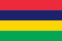
| Flag of Mauritius | |
Arab sailors were the first to discover the uninhabited island, around 975, and they called it Dina Arobi. In 1507, Portuguese sailors visited the uninhabited island. The island appears with the Portuguese names Cirne or Do-Cerne on early Portuguese maps. The Dutch took possession in 1598, establishing a succession of short-lived settlements over a period of about 120 years, before abandoning their efforts in 1710. France took control in 1715, renaming it Isle de France. In 1810, the United Kingdom seized the island, and four years later, in the Treaty of Paris, France ceded Mauritius and its dependencies to the United Kingdom. The British colony of Mauritius included Rodrigues, Agaléga, St. Brandon, the Chagos Archipelago, and, until 1906, the Seychelles. Mauritius and France dispute sovereignty over the island of Tromelin as the Treaty of Paris failed to mention it specifically. Mauritius remained a primarily plantation-based colony of the United Kingdom until independence in 1968.
Currency / Language
| ISO | Currency | Symbol | Significant figures |
|---|---|---|---|
| MUR | Mauritian rupee | ₨ | 2 |
| ISO | Language |
|---|---|
| EN | English language |
| FR | French language |


