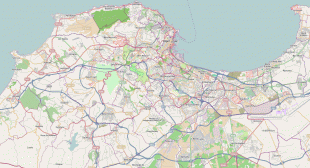
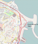
Algiers
 |
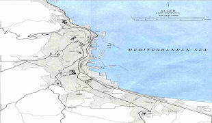
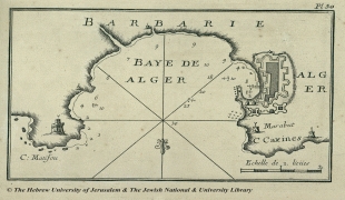
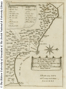
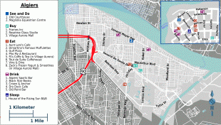
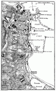
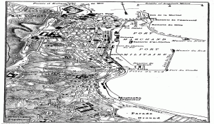
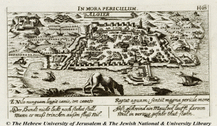
Algiers is situated on the west side of a bay of the Mediterranean Sea. The modern part of the city is built on the level ground by the seashore; the old part, the ancient city of the deys, climbs the steep hill behind the modern town and is crowned by the Casbah or citadel (a UNESCO World Heritage Site), 122 m above the sea. The casbah and the two quays form a triangle.
The city's name is derived via French and Catalan Alger from the Arabic name al-Jazāʾir (الجزائر), "The Islands". This name refers to the four former islands which lay off the city's coast before becoming part of the mainland in 1525. Al-Jazāʾir is itself a truncated form of the city's older name Jazaʾir Banī Mazghanna (جزائر بني مزغانة), "The Islands of the Banu Mazghanna", used by early medieval geographers such as Muhammad al-Idrisi and Yaqut al-Hamawi.
In classical antiquity, the ancient Greeks knew the town as Ikósion (Ἰκόσιον), which was Latinized as Icosium under Roman rule. The Greeks explained the name as coming from their word for "twenty" (εἴκοσι, eíkosi), supposedly because it had been founded by 20 companions of Hercules when he visited the Atlas Mountains during his labors.
Algiers is also known as el-Behdja (البهجة, "The Joyous") or "Algiers the White" (Alger la Blanche) for its whitewashed buildings, seen rising from the sea.
Map - Algiers
Map


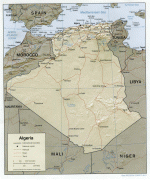
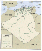
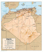
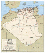

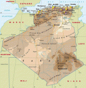
Country - Algeria
 |
|
| Flag of Algeria | |
Algeria produced and is linked to many civilizations, empires and dynasties, including ancient Numidians, Phoenicians, Carthaginians, Romans, Vandals, Byzantines, Umayyads, Abbasids, Rustamids, Idrisids, Aghlabids, Fatimids, Zirids, Hammadids, Almoravids, Almohads, Zayyanids, Spaniards, Ottomans and the French colonial empire, with the latter expanded into its present-boundaries. After 132 years of being part of France, tensions between France and the local Algerian populace led to the start of the Algerian War which concluded with Algeria obtaining its independence on 5 July 1962 with the establishment of the People's Democratic Republic on 20 September of that year.
Currency / Language
| ISO | Currency | Symbol | Significant figures |
|---|---|---|---|
| DZD | Algerian dinar | دج | 2 |
| ISO | Language |
|---|---|
| AR | Arabic language |