Map - Ali Sabieh Region (Ali Sabieh Region)

Ali Sabieh Region (Ali Sabieh Region)
Ali Sabieh Region (إقليم على صبيح, Gobolka Cali Sabiix) is a region in southern Djibouti. With a mainland area of 2,400 square kilometres (900 sq mi), it lies along the national border with Somaliland and Ethiopia, bordering also the Dikhil Region to the west and the Arta Region to the north. Its capital is Ali Sabieh. The Arrei Mountains are the highest point in the region.

Nomadic life in the Ali Sabieh Region dates back at least 2,000 years. During the Middle Ages, the Ali Sabieh Region was ruled by the Ifat Sultanate and the Adal Sultanate. It later formed a part of the French Somaliland protectorate in the first half of the 20th century. Considered the border with Ethiopia, the area had few permanent settlements at the turn of the 20th century. In 1904, a report notes that "when the border post of Ali Sabieh, it has the appearance of a fortress. Attached to the circle of "Gobad-Dikkil" from its inception in 1931, Ali Sabieh became the chief town of a circle autonomously 1939. It was briefly attached to the circle of Djibouti between 1946 and 1949. It is managed by the commander of the circle Dikhil between 1952 and 1958, before finally receive its own administration.

 
Map - Ali Sabieh Region (Ali Sabieh Region)
Country - Djibouti
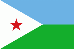
Flag of Djibouti
Djibouti, officially the Republic of Djibouti, is a country in the Horn of Africa, bordered by Somalia to the south, Ethiopia to the southwest, Eritrea in the north, and the Red Sea and the Gulf of Aden to the east. The country has an area of 8958 sqmi.

In antiquity, the territory, together with Ethiopia, Eritrea and Somaliland, was part of the Land of Punt. Nearby Zeila, now in Somaliland, was the seat of the medieval Adal and Ifat Sultanates. In the late 19th century, the colony of French Somaliland was established after the ruling Dir Somali sultans signed treaties with the French, and its railroad to Dire Dawa (and later Addis Ababa) allowed it to quickly supersede Zeila as the port for southern Ethiopia and the Ogaden. It was renamed the French Territory of the Afars and the Issas in 1967. A decade later, the Djiboutian people voted for independence. This officially marked the establishment of the Republic of Djibouti, named after its capital city. The new state joined the United Nations. In the early 1990s, tensions over government representation led to armed conflict, which ended in a power-sharing agreement in 2000 between the ruling party and the opposition.
Currency / Language  
ISO Currency Symbol Significant figures
DJF Djiboutian franc Fr 0
Neighbourhood - Country  
  •  Eritrea 
  •  Ethiopia 
  •  Somalia 
Administrative Subdivision
City, Village,...