Aligider
Ali Ghider (علي قدر) is located nine kilometers to the west of Teseney in the country of Eritrea. It is part of the Teseney sub-zone and has a diverse population. It is considered the last settlement in Eritrea before reaching the Sudanese Border and is located in the lowlands.
Agriculture, livestock raising and trade are very important to the economy of the area. Ali Ghider has access to potable water from both the Gash River and underground water resources. Processes of irrigation have created an artificial marsh near the Gash River which provides a large habitat for many bird species.
Ali Ghider was once an Italian frontier village. Ali Ghider was an agricultural area, growing cotton and other crops, and managed by the Societa Impresse Africana (SIA). SIA helped develop Ali Ghider into a company town, housing tenant farmers and other workers on the plantation. A school and clinic were set up and by the 1950s, the plantation employed 2,000 Eritreans, 15 Italians and "provided a residence for another 12,000 part time workers and family members."
A well-known Italian business that was established for many years in Ali Ghider was the Barattolo cotton plantation which was established in 1965 by Roberto Barattolo in a purchase from SIA. This acquisition from the SIA allowed Barattolo to export knitwear to both Europe and the Middle East.
Ali Ghider received significant damage from the sacking by Ethiopian forces. Many of the Italian artifacts left from its time as a frontier village were destroyed in 2001 through Ethiopian military actions.
Map - Aligider
Map
Country - Eritrea
 |
 |
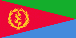
| Flag of Eritrea | |
Human remains found in Eritrea have been dated to 1 million years old and anthropological research indicates that the area may contain significant records related to the evolution of humans. Contemporary Eritrea is a multi-ethnic country with nine recognised ethnic groups. Nine different languages are spoken by the nine recognised ethnic groups, the most widely spoken language being Tigrinya, the others being Tigre, Saho, Kunama, Nara, Afar, Beja, Bilen and Arabic. Tigrinya, Arabic, and English serve as the three working languages. Most residents speak languages from the Afroasiatic family, either of the Ethiopian Semitic languages or Cushitic branches. Among these communities, the Tigrinyas make up about 55% of the population, with the Tigre people constituting around 30% of inhabitants. In addition, there are several Nilo-Saharan-speaking Nilotic ethnic groups. Most people in the country adhere to Christianity or Islam, with a small minority adhering to traditional faiths.
Currency / Language
| ISO | Currency | Symbol | Significant figures |
|---|---|---|---|
| ERN | Eritrean nakfa | Nfk | 2 |
| ISO | Language |
|---|---|
| AA | Afar language |
| AR | Arabic language |
| TI | Tigrinya language |


