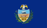
Allegheny County (Allegheny County)
 |
 |
Allegheny was the first county in Pennsylvania to be given a Native American name. It was named after the Lenape word for the Allegheny River. The meaning of "Allegheny" is uncertain. It is usually said to mean "fine river". Stewart says that the name may come from a Lenape account of an ancient mythical tribe called "Allegewi", who lived along the river before being taken over by the Lenape.
Prior to European contact, this area was settled for thousands of years by succeeding cultures of indigenous peoples. During the colonial era, historic native groups known by the colonists to settle in the area included members of western nations of the Iroquois, such as the Seneca; the Lenape, who had been pushed from the East by European-American settlers; the Shawnee, who also had territory in Ohio; and the Mingo, a group made up of a variety of peoples from more eastern tribes.
European fur traders such as Peter Chartier established trading posts in the region in the early eighteenth century.
In 1749, Captain Pierre Joseph Céloron de Blainville claimed the Ohio Valley and all of western Pennsylvania for King Louis XV of France. The captain traveled along the Ohio and Allegheny rivers. He installed lead plates in the ground to mark the land for France.
Most of the towns during that era were developed along waterways, which were the primary transportation routes, as well as providing water for domestic uses. Through the eighteenth century, both the French and the British competed for control over the local rivers in this frontier territory of North America. Native American bands and tribes allied with the colonists to differing degrees, often based on their trading relationships. The British sent Major George Washington to expel the French from their posts, with no success. He also nearly drowned in the ice-filled Allegheny River while returning to camp.
The English tried again in 1754 to establish a post in the area. They sent 41 Virginians to build Fort Prince George. The French learned of the plan and sent an army to capture the fort. They resumed building it and added increased defensive fortification, renaming it as Fort Duquesne.
Given its strategic location at the Ohio, Fort Duquesne became an important focal point of the French and Indian War. The first British attempt to retake the fort, the Braddock Expedition, failed miserably. In 1758 British forces under General John Forbes recaptured the fort; he had it destroyed to prevent any use by the French. The British built a new, larger fort on the site, including a moat, and named it Fort Pitt. The historic site has been preserved as Pittsburgh's Point State Park.
Under their colonial charters, both Pennsylvania and Virginia claimed the region that is now Allegheny County. Pennsylvania administered most of the region as part of its Westmoreland County. Virginia considered everything south of the Ohio River and east of the Allegheny River to be part of its Yohogania County, and governed it from Fort Dunmore. In addition, parts of the county were located in the proposed British colony of Vandalia and the proposed U.S. state of Westsylvania. The overlapping boundaries, multiple governments, and confused deed claims soon proved unworkable. Near the end of the American Revolutionary War, in 1780 Pennsylvania and Virginia agreed to extend the Mason–Dixon line westward. This region was assigned to Pennsylvania. From 1781 until 1788, much of what Virginia had claimed as part of Yohogania County was administered as a part of the newly created Washington County, Pennsylvania.
Allegheny County was officially created on September 24, 1788, from parts of Washington and Westmoreland counties. It was formed to respond to pressure from the increase in settlers living in the area around Pittsburgh; this was designated as the county seat in 1791. The county originally extended north to the shores of Lake Erie; it was reduced to its current borders by 1800. As population increased in the territory, other counties were organized.
Map - Allegheny County (Allegheny County)
Map
Country - United_States
 |
 |
| Flag of the United States | |
Indigenous peoples have inhabited the Americas for thousands of years. Beginning in 1607, British colonization led to the establishment of the Thirteen Colonies in what is now the Eastern United States. They quarreled with the British Crown over taxation and political representation, leading to the American Revolution and proceeding Revolutionary War. The United States declared independence on July 4, 1776, becoming the first nation-state founded on Enlightenment principles of unalienable natural rights, consent of the governed, and liberal democracy. The country began expanding across North America, spanning the continent by 1848. Sectional division surrounding slavery in the Southern United States led to the secession of the Confederate States of America, which fought the remaining states of the Union during the American Civil War (1861–1865). With the Union's victory and preservation, slavery was abolished nationally by the Thirteenth Amendment.
Currency / Language
| ISO | Currency | Symbol | Significant figures |
|---|---|---|---|
| USD | United States dollar | $ | 2 |
| ISO | Language |
|---|---|
| EN | English language |
| FR | French language |
| ES | Spanish language |


