Am Timan (Am-Timan)
Am Timan (Arabic: أم تيمان, ʾUmm Tīmān) is a city in Chad and is the capital of the region of Salamat. Am Timan is also known as Dabengat in Chad, which mean the resources of the products. Most of economy comes from Salamat region such as fish, vegetables and anomalies meat etc. In Arabic, Am Timan means "mother of twins," although the reason for the name was back then there a female of Buffalo gave a twins birth in that particular place so the name came from there/ As the capital of the prefecture, it has the area' of many towns and villages around it including Zakuma national park. The city has no university but there are schools and colleges, and a clinic, and hosts a large market day and holiday celebrations.
During the conflict period, a cotton plantation and processing plant just outside the city were destroyed.
The city's sand airport was upgraded by the French Foreign Legion in 1971 to allow military air transports to supply the anti-rebel effort. At the time, the only practical way in or out of the city was by air.
Since the dry season lasts for about seven months of the year, water becomes a problem as the dry season progresses. Aquifers are accessed by digging deeper and deeper into the bed of the Bahr Salamat (river). The river starts flowing with the onset of rain, however, and the children enjoy swimming in it.
Map - Am Timan (Am-Timan)
Map
Country - Chad
 |
 |
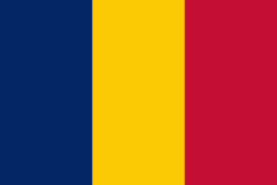
| Flag of Chad | |
Chad has several regions: a desert zone in the north, an arid Sahelian belt in the centre and a more fertile Sudanian Savanna zone in the south. Lake Chad, after which the country is named, is the second-largest wetland in Africa. Chad's official languages are Arabic and French. It is home to over 200 different ethnic and linguistic groups. Islam (55.1%) and Christianity (41.1%) are the main religions practiced in Chad.
Currency / Language
| ISO | Currency | Symbol | Significant figures |
|---|---|---|---|
| XAF | Central African CFA franc | Fr | 0 |
| ISO | Language |
|---|---|
| AR | Arabic language |
| FR | French language |


