American Samoa (American Samoa)
 |
 |
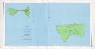
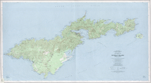
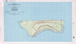
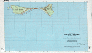
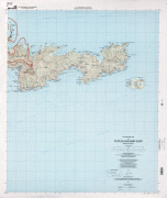
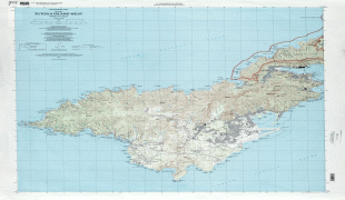
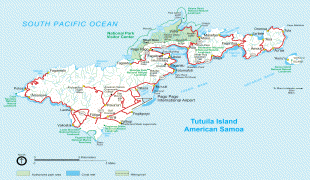
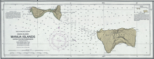
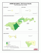
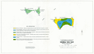
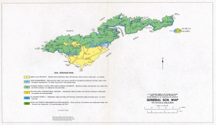
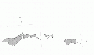
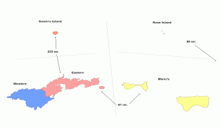
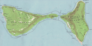
American Samoa consists of five main islands and two coral atolls; the largest and most populous island is Tutuila, with the Manuʻa Islands, Rose Atoll and Swains Island also included in the territory. All islands except for Swains Island are part of the Samoan Islands, The total land area is 199 sqkm, slightly more than Washington, D.C. As of 2022, the population of American Samoa is approximately 45,443 people, of whom the vast majority are indigenous ethnic Samoans. Most American Samoans are bilingual and can speak English and Samoan fluently.
Inhabited by Polynesians since prehistoric times, American Samoa was first contacted by Europeans in the 18th century. The islands attracted missionaries, explorers, and mariners, particularly to its highly protected natural harbor of Pago Pago. The United States took possession of American Samoa in the late 19th century, developing it into a major naval outpost; its strategic value was reinforced by the Second World War and subsequent Cold War. In 1967, the territory became self-governing with the adoption of a constitution; into the 21st century, it remains unorganized and thus directly administered by the federal government. It has been a member of the Pacific Community since 1983.
Due to its strategic location, the U.S. military has a significant presence in American Samoa and plays a major role in its economy and society. The territory is noted for having the highest rate of military enlistment of any U.S. state or territory; as of 2021, the local U.S. Army recruiting station in Pago Pago ranked first in recruitment. Tuna products are the main exports, with the rest of the U.S. serving as the largest trading partner. Tourism is a nascent but underdeveloped sector, owing in part to the territory's relative geographic isolation, which also accounts for its high rate of poverty and emigration.
Residents of American Samoa are politically disenfranchised, with no voting representation in the U.S. Congress. American Samoa is the only permanently inhabited territory of the United States in which citizenship is not granted at birth, and people born there are considered "non-citizen nationals" with limited rights.
Traditional oral literature of Samoa and Manuʻa talks of a widespread Polynesian network or confederacy (or "empire") that was prehistorically ruled by the successive Tui Manuʻa dynasties. Manuan genealogies and religious oral literature also suggest that the Tui Manuʻa had long been one of the most prestigious and powerful paramounts of Samoa. Oral history suggests that the Tui Manuʻa kings governed a confederacy of far-flung islands which included Fiji, Tonga as well as smaller western Pacific chiefdoms and Polynesian outliers such as Uvea, Futuna, Tokelau, and Tuvalu. Commerce and exchange routes between the western Polynesian societies are well documented and it is speculated that the Tui Manuʻa dynasty grew through its success in obtaining control over the oceanic trade of currency goods such as finely woven ceremonial mats, whale ivory "tabua", obsidian and basalt tools, chiefly red feathers, and seashells reserved for royalty (such as polished nautilus and the egg cowry).