Antwerp (Provincie Antwerpen)
 |
 |
During the early Middle Ages the region was part of the Frankish Empire, which was divided into several pagi. The territory of the present-day province belonged to several pagi of which the region around what would become the city of Antwerp belonged to the Pagus Renesium. The Pagus Toxandria stretched from North Brabant into the Campine region. To the south there was the Pagus Bracbatinsis and the Pagus Hasbaniensis. In 843 the Carolingian Empire of Charlemagne was divided among his sons and the river Scheldt became the border between West Francia and East Francia. In 974 Otto II established the Margraviate of Antwerp as a defence against the County of Flanders.
In 1106, Henry V granted the Margraviate to Godfrey I of Leuven. His descendants would from 1235 onwards become the Dukes of Brabant and the region itself was the northern part of the Duchy of Brabant. In 1430 the Duchy became part of the Duchy of Burgundy until 1477 when it fell to the House of Habsburg. In 1713, at the end of the Spanish Succession War the region became part of the Austrian Netherlands until 1794, with in 1790 the short lived United States of Belgium. On 1 October 1795 the former Austrian Netherlands were annexed by France under the French Directory.
The modern province was created as the Department of the two Netes during the First French Empire (when the Southern Netherlands were part of France). After the defeat of Napoleon, the territory became part of the United Kingdom of the Netherlands as the province of Central Brabant, distinguishing it from North Brabant and South Brabant. In 1830, after Belgium's independence the province was renamed Antwerp (after its major city and capital).
Map - Antwerp (Provincie Antwerpen)
Map
Country - Belgium
 |
 |
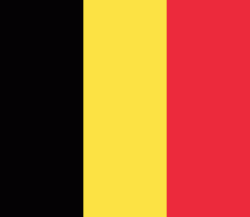
| Flag of Belgium | |
Belgium is a sovereign state and a federal constitutional monarchy with a parliamentary system. Its institutional organization is complex and is structured on both regional and linguistic grounds. It is divided into three highly autonomous regions: the Flemish Region (Flanders) in the north, the Walloon Region (Wallonia) in the south, and the Brussels-Capital Region. Brussels is the smallest and most densely populated region, as well as the richest region in terms of GDP per capita. Belgium is also home to two main linguistic communities: the Flemish Community, which constitutes about 60 percent of the population, and the French Community, which constitutes about 40 percent of the population. A small German-speaking Community, numbering around one percent, exists in the East Cantons. The Brussels-Capital Region is officially bilingual in French and Dutch, although French is the dominant language.
Currency / Language
| ISO | Currency | Symbol | Significant figures |
|---|---|---|---|
| EUR | Euro | € | 2 |
| ISO | Language |
|---|---|
| NL | Dutch language |
| FR | French language |
| DE | German language |


