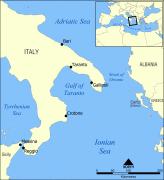
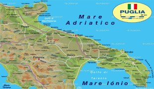
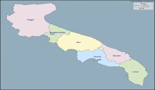
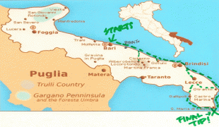
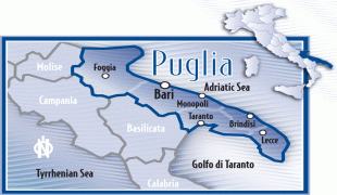
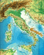
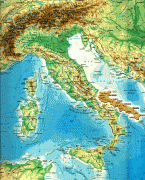
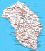
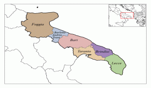
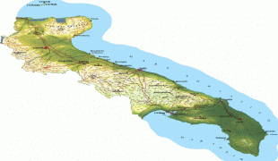
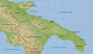
Apulia (Puglia)
 |
 |
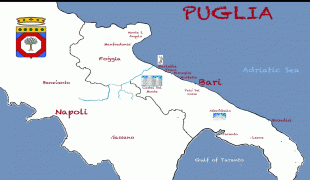
It is bordered by the other Italian regions of Molise to the north, Campania to the west, and Basilicata to the southwest. Its chief town is Bari.
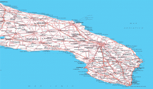
Apulia's coastline is longer than that of any other mainland Italian region. In the north, the Gargano promontory extends out into the Adriatic sea like a 'sperone' ("spur"), while in the south, the Salento peninsula forms the 'tacco' ("heel") of Italy's boot. The highest peak in the region is Monte Cornacchia (1.152 m/3.779 ft above sea level) within the Daunian Mountains, in the north along the Apennines.
It is home to two national parks, the Alta Murgia National Park and Gargano National Park.
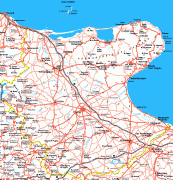
Outside national parks in the North and West, most of Apulia and particularly the Salento peninsula is geographically flat with only moderate hills.
The climate is typically Mediterranean with hot, dry and sunny summers and mild and rainy winters. Snowfall, especially on the coast is rare but has occurred as recently as January 2019 (following on from snow in March 2018 and January 2017). Apulia is among the hottest and driest regions of Italy in summer with temperatures sometimes reaching up to and above 40 °C/104 °F in Lecce and Foggia.
The coastal areas, particularly on the Adriatic sea and in the southern Salento peninsula, are frequently exposed to winds of varying strengths and directions, strongly affecting local temperatures and conditions, sometimes within the same day. The Northerly Bora wind from the Adriatic sea can lower temperatures, humidity and moderate summer heat while the Southerly Sirocco wind from North Africa can raise temperatures, humidity and occasionally drop red dust from the Sahara desert. On some days in spring and autumn/fall, it can be warm enough to swim in Gallipoli and Porto Cesareo on the Ionian coast while at the same time, cool winds warrant jackets and jumpers/sweaters in Monopoli and Otranto on the Adriatic coast.
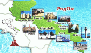
The area that is in between Otranto and Santa Maria di Leuca is part of the Regional Natural Coastal Park of "Costa Otranto - Santa Maria di Leuca e Bosco di Tricase" wanted by the Apulia Region in 2008. This territory has numerous natural and historical attractions such as Ciolo, which is a rocky cove.
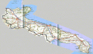
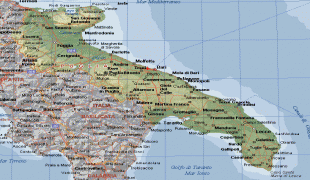
Map - Apulia (Puglia)
Map


Country - Italy
 |
 |
| Flag of Italy | |
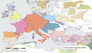
Italy was the native place of many civilizations such as the Italic peoples and the Etruscans, while due to its central geographic location in Southern Europe and the Mediterranean, the country has also historically been home to myriad peoples and cultures, who immigrated to the peninsula throughout history. The Latins, native of central Italy, formed the Roman Kingdom in the 8th century BC, which eventually became a republic with a government of the Senate and the People. The Roman Republic initially conquered and assimilated its neighbours on the Italian peninsula, eventually expanding and conquering a large part of Europe, North Africa and Western Asia. By the first century BC, the Roman Empire emerged as the dominant power in the Mediterranean Basin and became a leading cultural, political and religious centre, inaugurating the Pax Romana, a period of more than 200 years during which Italy's law, technology, economy, art, and literature developed.
Currency / Language
| ISO | Currency | Symbol | Significant figures |
|---|---|---|---|
| EUR | Euro | € | 2 |
| ISO | Language |
|---|---|
| CA | Catalan language |
| CO | Corsican language |
| FR | French language |
| DE | German language |
| IT | Italian language |
| SC | Sardinian language |
| SL | Slovene language |


