Armavir Province (Armaviri Marz)
The province is home to the spiritual centre of the Armenian nation; the Mother See of Holy Etchmiadzin of the Armenian Apostolic Church. It is the seat of the Catholicos of All Armenians.
The province is named after the ancient city of Armavir founded in 331 BC. The province is also the site of the decisive Battle of Sardarabad in 1918 that resulted in the foundation of the Republic of Armenia. The battle is seen as a crucial historical event not only by stopping the Turkish advance into the rest of Armenia but also preventing the complete destruction of the Armenian nation.
The Metsamor Nuclear Power Plant is also located in Armavir Province near the town of Metsamor.
The Yerevan Zvartnots International Airport is located near the village of Parakar in Armavir Province (12 km west of Yerevan).
The province is named after the ancient city of Armavir, one of the 13 historic capitals of Armenia. According to Movses Khorenatsi, ancient Armavir was built by Aramayis; the grandson of Hayk, who moved from Taron to the Ararat plain.
Map - Armavir Province (Armaviri Marz)
Map
Country - Armenia
 |
 |
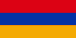
| Flag of Armenia | |
Armenia is a unitary, multi-party, democratic nation-state with an ancient cultural heritage. The first Armenian state of Urartu was established in 860 BC, and by the 6th century BC it was replaced by the Satrapy of Armenia. The Kingdom of Armenia reached its height under Tigranes the Great in the 1st century BC and in the year 301 became the first state in the world to adopt Christianity as its official religion. The ancient Armenian kingdom was split between the Byzantine and Sasanian Empires around the early 5th century. Under the Bagratuni dynasty, the Bagratid Kingdom of Armenia was restored in the 9th century. Declining due to the wars against the Byzantines, the kingdom fell in 1045 and Armenia was soon after invaded by the Seljuk Turks. An Armenian principality and later a kingdom Cilician Armenia was located on the coast of the Mediterranean Sea between the 11th and 14th centuries.
Currency / Language
| ISO | Currency | Symbol | Significant figures |
|---|---|---|---|
| AMD | Armenian dram | Ö | 2 |
| ISO | Language |
|---|---|
| HY | Armenian language |


