Asmara International Airport (Asmara Airport)
Asmara International Airport,, is the international airport of Asmara, the capital of Eritrea. It is the country's largest airport and, as of 2017, the only one receiving regularly scheduled services.
The airport was constructed by the Italian colonial authorities in 1922, the first such facility to be opened in Italian Eritrea with the name "Aeroporto di Gura". It served as the main military airport in the territory. In the mid-1930s, the airport (enlarged and now called Aeroporto Civile Umberto Maddalena di Asmara ) began offering civilian and commercial flights.
On 7 July 1935, an agreement was signed with British "Imperial Airways" to connect Asmara to Khartoum. A regular Kassala-Khartoum-Asmara-Massawa 770 km commercial route was subsequently started with a Caproni 133 of the Italian Ala Littoria.
Additionally, a regular Asmara-Assab- Mogadishu commercial route was started in summer 1935, with an Ala Littoria's Caproni Ca.133 providing 13-hour flights from the Mogadishu airport to Italian Eritrea. The aircraft had a maximal capacity of 18 passengers, which at the time was a record.
In 1936, Ala Littoria launched an intercontinental connection -called "Linea dell'Impero"- between Mogadishu-Asmara-Khartoum-Tripoli and Rome. The voyage lasted four days and was one of the first long range flights in the world.
During World War II, the airport was nearly destroyed by the British. It was later renovated in the 1950s, and reopened to offer flights to Addis Ababa and other cities in Ethiopia. With Eritrea's independence in the 1990s, the airport became an international portal to the new nation.
During the Eritrean-Ethiopian War, the airport was bombed two times by Ethiopia. The first was in 1998 and another in 2000. In April 2003, after improvements to the airport's runways, Eritrean Airlines started regular services between Asmara and Frankfurt, Milan, Nairobi and Rome. In 2004, it served 136,526 passengers (+11.8% vs. 2003). in 2018, after renewed relations with Ethiopia, the airport started accepting flights from Addis Ababa for the first time since the war.
| IATA Code | ASM | ICAO Code | HHAS | FAA Code | |
|---|---|---|---|---|---|
| Telephone | Fax | ||||
| Home page |
Map - Asmara International Airport (Asmara Airport)
Map
Country - Eritrea
 |
 |
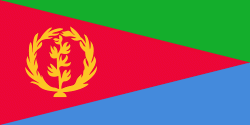
| Flag of Eritrea | |
Human remains found in Eritrea have been dated to 1 million years old and anthropological research indicates that the area may contain significant records related to the evolution of humans. Contemporary Eritrea is a multi-ethnic country with nine recognised ethnic groups. Nine different languages are spoken by the nine recognised ethnic groups, the most widely spoken language being Tigrinya, the others being Tigre, Saho, Kunama, Nara, Afar, Beja, Bilen and Arabic. Tigrinya, Arabic, and English serve as the three working languages. Most residents speak languages from the Afroasiatic family, either of the Ethiopian Semitic languages or Cushitic branches. Among these communities, the Tigrinyas make up about 55% of the population, with the Tigre people constituting around 30% of inhabitants. In addition, there are several Nilo-Saharan-speaking Nilotic ethnic groups. Most people in the country adhere to Christianity or Islam, with a small minority adhering to traditional faiths.
Currency / Language
| ISO | Currency | Symbol | Significant figures |
|---|---|---|---|
| ERN | Eritrean nakfa | Nfk | 2 |
| ISO | Language |
|---|---|
| AA | Afar language |
| AR | Arabic language |
| TI | Tigrinya language |


