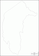
Australian Capital Territory (Australian Capital Territory)
 |
 |
On 1 January 1901, federation of the colonies of Australia was achieved. Section 125 of the new Australian Constitution provided that land, situated in New South Wales and at least 100 miles from Sydney, would be ceded to the new federal government. Following discussion and exploration of various areas within New South Wales, the Seat of Government Act 1908 was passed in 1908 which specified a capital in the Yass-Canberra region. The territory was transferred to the federal government by New South Wales in 1911, two years prior to the capital city being founded and formally named as Canberra in 1913.
While the overwhelming majority of the population reside in the city of Canberra in the ACT's north-east, the territory also includes some surrounding townships such as Williamsdale, Naas, Uriarra, Tharwa and Hall. The ACT also includes the Namadgi National Park which comprises the majority of land area of the territory. Despite a common misconception, the Jervis Bay Territory is not part of the ACT although the laws of the Australian Capital Territory apply as if Jervis Bay did form part of the ACT. The territory has a relatively dry, continental climate experiencing warm to hot summers and cool to cold winters.
The Australian Capital Territory is home to many important institutions of the federal government, national monuments and museums. This includes the Parliament of Australia, the High Court of Australia, the Australian Defence Force Academy and the Australian War Memorial. It also hosts the majority of foreign embassies in Australia as well as regional headquarters of many international organisations, not-for-profit groups, lobbying groups and professional associations. Several major universities also have campuses in the ACT including the Australian National University, the University of Canberra, the University of New South Wales, Charles Sturt University and the Australian Catholic University.
A locally elected legislative assembly has governed the territory since 1988. However, the Commonwealth maintains authority over the territory and may overturn local laws. It still maintains control over the area known as the Parliamentary Triangle through the National Capital Authority. Residents of the territory elect three members of the House of Representatives and two senators.
With 453,324 residents, the Australian Capital Territory is the second smallest mainland state or territory by population. At the, the median weekly income for people in the territory aged over 15 was $998, significantly higher than the national average of $662. The average level of degree qualification in the ACT is also higher than the national average. Within the ACT, 37.1% of the population hold a bachelor's degree level or above education compared to the national figure of 20%.
In September 2022, it was announced the border between NSW and the ACT would change for the first time since it was created in 1911. ACT chief minister Andrew Barr said NSW premier Dominic Perrottet had agreed to a proposed border change of 330 ha in the Ginninderra watershed.
Map - Australian Capital Territory (Australian Capital Territory)
Map
Country - Australia
 |
 |
| Flag of Australia | |
The ancestors of Aboriginal Australians began arriving from south east Asia approximately 65,000 years ago, during the last ice age. Arriving by sea, they settled the continent and had formed approximately 250 distinct language groups by the time of European settlement, maintaining some of the longest known continuing artistic and religious traditions in the world. Australia's written history commenced with the European maritime exploration of Australia. The Dutch navigator Willem Janszoon was the first known European to reach Australia, in 1606. In 1770, the British explorer James Cook mapped and claimed the east coast of Australia for Great Britain, and the First Fleet of British ships arrived at Sydney in 1788 to establish the penal colony of New South Wales. The European population grew in subsequent decades, and by the end of the 1850s gold rush, most of the continent had been explored by European settlers and an additional five self-governing British colonies established. Democratic parliaments were gradually established through the 19th century, culminating with a vote for the federation of the six colonies and foundation of the Commonwealth of Australia on 1 January 1901. Australia has since maintained a stable liberal democratic political system and wealthy market economy.
Currency / Language
| ISO | Currency | Symbol | Significant figures |
|---|---|---|---|
| AUD | Australian dollar | $ | 2 |
| ISO | Language |
|---|---|
| EN | English language |


