Autonomous Region of Bougainville (Bougainville)
 |
 |
In 2011, the region had an estimated population of 250,000. The lingua franca of Bougainville is Tok Pisin, while a variety of Austronesian and non-Austronesian languages are also spoken. The region includes several Polynesian outliers where Polynesian languages are spoken. Geographically the islands of Bougainville and Buka form part of the Solomon Islands archipelago, but are politically separate from the independent country of Solomon Islands. Historically, Bougainville and Buka, together with the islands of Choiseul, Santa Isabel, the Shortlands and Ontong Java, which are all now part of the country of Solomon Islands, formed the German Solomon Islands Protectorate, the geographical area later being referred to as the North Solomon Islands.
Bougainville has been inhabited by humans for at least 29,000 years. During the colonial period the region was occupied and administered by the Germans, Australians, Japanese, and Americans for various periods. The name of the region originates from French admiral Louis Antoine de Bougainville, who reached it in 1768.
Bougainvillean separatism dates to the 1960s, and the Republic of the North Solomons was declared shortly before the independence of Papua New Guinea in 1975; it was subsumed into Papua New Guinea the following year. Conflict over the Panguna mine became the primary trigger for the Bougainville Civil War (1988–1998), which resulted in the deaths of up to 20,000 people. A peace agreement resulted in the creation of the Autonomous Bougainville Government.
In late 2019, a non-binding independence referendum was held with 98.31% voting for independence rather than continued autonomy within Papua New Guinea. As a result, the regional authorities intend to become independent by the end of 2027, pending ratification by the Papuan New Guinea government. If ratified, the capital may relocate from Buka back to the previous location of Arawa.
Map - Autonomous Region of Bougainville (Bougainville)
Map


Country - Papua_New_Guinea
 |
 |
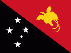
| Flag of Papua New Guinea | |
At the national level, after being ruled by three external powers since 1884, including nearly 60 years of Australian administration starting during World War I, Papua New Guinea established its sovereignty in 1975. It became an independent Commonwealth realm in 1975 with Elizabeth II as its queen. It also became a member of the Commonwealth of Nations in its own right.
Currency / Language
| ISO | Currency | Symbol | Significant figures |
|---|---|---|---|
| PGK | Papua New Guinean kina | K | 2 |
| ISO | Language |
|---|---|
| EN | English language |
| HO | Hiri Motu language |