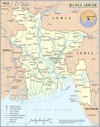
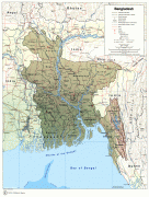
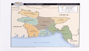
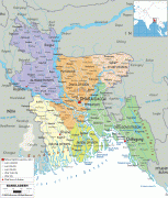
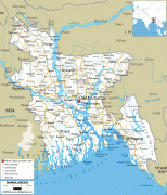
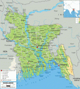
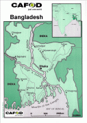
Bangladesh
 |
 |
| Flag of Bangladesh | |
The official language is Bengali, one of the easternmost branches of the Indo-European language family.
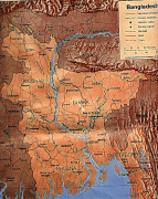
Bangladesh forms the sovereign part of the historic and ethnolinguistic region of Bengal, which was divided during the Partition of India in 1947.
The country has a Bengali Muslim majority.
Ancient Bengal was an important cultural centre in the Indian subcontinent as the home of the states of Vanga, Pundra, Gangaridai, Gauda, Samatata, and Harikela.
Currency / Language
| ISO | Currency | Symbol | Significant figures |
|---|---|---|---|
| BDT | Bangladeshi taka | ৳ | 2 |
| ISO | Language |
|---|---|
| BN | Bengali language |
| EN | English language |