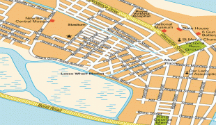
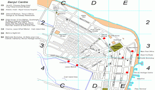
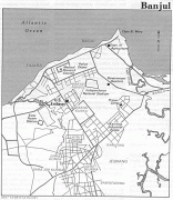
Map - Banjul

Banjul
Banjul, officially the City of Banjul, is the capital and fourth largest city of The Gambia. It is the centre of the eponymous administrative division which is home to an estimated 400,000 residents, making it The Gambia's largest and most densely populated metropolitan area. Banjul is on St Mary's Island (Banjul Island), where the Gambia River enters the Atlantic Ocean. The population of the city proper is 31,301, with the Greater Banjul Area, which includes the City of Banjul and the Kanifing Municipal Council, at a population of 413,397 (2013 census). The island is connected to the mainland to the west and the rest of Greater Banjul Area via bridges. There are also ferries linking Banjul to the mainland at the other side of the river.

From the 19th century until 24 April 1973, the city was known as Bathurst.

Banjul takes its name from the Mandinka people who gathered specific fibres on the island, which were used in the manufacture of ropes. Bang julo is the Mandinka word for rope fibre.
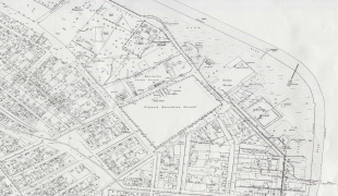
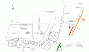
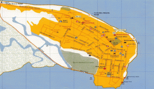
 
Map - Banjul
Map
Google - Map - Banjul
Google
Google Earth - Map - Banjul
Google Earth
Nokia - Map - Banjul
Nokia
Openstreetmap - Map - Banjul
Openstreetmap
bathurst_1941.jpg
2400x1688
www.lib.utexas.edu
GambiaMap_sheet6.jpg
1170x1653
www.columbia.edu
GambiaMap_sheet8.jpg
1170x1653
www.columbia.edu
route_map.jpg
1566x1065
www.gcaa.aero
planBANJUL.jpg
1428x954
www.afritramp.fr
gambia_pol88.jpg
1040x1234
www.worldportsource....
banjul-street-map.jp...
1187x906
www.accessgambia.com
Serrekunda-Resort-Ma...
894x1179
mappery.com
Serrekunda-Resort-Ma...
894x1179
www.mappery.com
Stadtplan-Banjul-767...
1000x1000
hot-map.com
Gambia-1-Map.jpg
935x1013
mappery.com
gamb-LMAP-md.png
965x966
www.operationworld.o...
Banjul-Gambia-City-C...
1100x843
mappery.com
Banjul-Gambia-City-C...
1100x843
www.mappery.com
restaurant-locations...
924x965
www.accessgambia.com
Mapa-Topografico-de-...
846x978
mapas.owje.com
gambia-map-e.jpg
872x796
www.accessgambia.com
guest-houses-banjul....
800x800
www.travelpod.com
fajara-map.jpg
770x625
www.accessgambia.com
gambia-capital-city-...
800x600
www.24point0.com
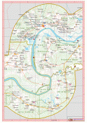
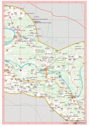
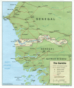
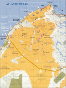
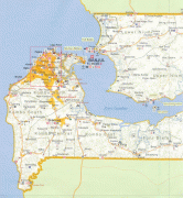
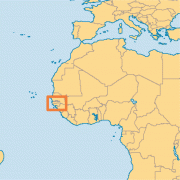
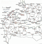
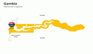
Country - The_Gambia
The Gambia, officially the Republic of The Gambia, is a country in West Africa. It is the smallest country within mainland Africa and is surrounded by Senegal, except for its western coast on the Atlantic Ocean. The Gambia is situated on both sides of the lower reaches of the Gambia River, the nation's namesake, which flows through the centre of the Gambia and empties into the Atlantic Ocean, and elucidates the long shape of the country. It has an area of 11300 km² with a population of 1,857,181 as of the April 2013 census. Banjul is the Gambian capital and the country's largest metropolitan area, while the largest cities are Serekunda and Brikama.

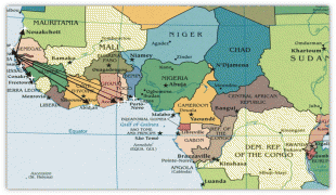
The Portuguese in 1455 entered the Gambian region, the first Europeans to do so, but never established important trade there. In 1765, the Gambia was made a part of the British Empire by establishment of the Gambia. In 1965, the Gambia gained independence under the leadership of Dawda Jawara, who ruled until Yahya Jammeh seized power in a bloodless 1994 coup. Adama Barrow became the Gambia's third president in January 2017, after defeating Jammeh in the December 2016 elections. Jammeh initially accepted the results, before refusing to leave office, triggering a constitutional crisis and military intervention by the Economic Community of West African States that resulted in his removal two days after his term was initially scheduled to end.
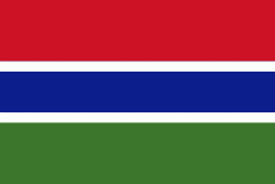
Currency / Language  
ISO Currency Symbol Significant figures
GMD Gambian dalasi D 2
Neighbourhood - Country  
  •  Senegal