Barbados
 |
 |
| Flag of Barbados | |
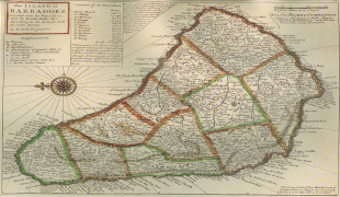
Inhabited by Kalinago people since the 13th century, and prior to that by other Amerindians, Spanish navigators took possession of Barbados in the late 15th century, claiming it for the Crown of Castile. It first appeared on a Spanish map in 1511. The Portuguese Empire claimed the island between 1532 and 1536, but abandoned it in 1620 with their only remnants being an introduction of wild boars for a good supply of meat whenever the island was visited. An English ship, the Olive Blossom, arrived in Barbados on 14 May 1625; its men took possession of the island in the name of King James I. In 1627, the first permanent settlers arrived from England, and Barbados became an English and later British colony. During this period, the colony operated on a plantation economy, relying on the labour of African slaves who worked on the island's plantations. Slavery continued until it was phased out through most of the British Empire by the Slavery Abolition Act 1833.
On 30 November 1966, Barbados gained independence and became a Commonwealth realm with Elizabeth II as Queen of Barbados. On 30 November 2021, Barbados transitioned to a republic within the Commonwealth.
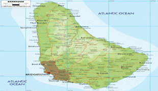
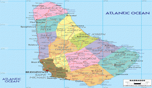
Barbados's population is predominantly of African ancestry. While it is technically an Atlantic island, Barbados is closely associated with the Caribbean and is ranked as one of its leading tourist destinations.
The name "Barbados" is from either the Portuguese term os barbados or the Spanish equivalent, los barbados, both meaning "the bearded ones". It is unclear whether "bearded" refers to the long, hanging roots of the bearded fig-tree (Ficus citrifolia), a species of banyan indigenous to the island, or to the allegedly bearded Caribs who once inhabited the island, or, more fancifully, to a visual impression of a beard formed by the sea foam that sprays over the outlying coral reefs. In 1519, a map produced by the Genoese mapmaker Visconte Maggiolo showed and named Barbados in its correct position. Furthermore, the island of Barbuda in the Leewards is very similar in name and was once named "Las Barbudas" by the Spanish.
The original name for Barbados in the Pre-Columbian era was Ichirouganaim, according to accounts by descendants of the indigenous Arawakan-speaking tribes in other regional areas, with possible translations including "Red land with white teeth" or "Redstone island with teeth outside (reefs)" or simply "Teeth".
Colloquially, Barbadians refer to their home island as "Bim" or other nicknames associated with Barbados, including "Bimshire". The origin is uncertain, but several theories exist. The National Cultural Foundation of Barbados says that "Bim" was a word commonly used by slaves, and that it derives from the Igbo term bém from bé mụ́ meaning "my home, kindred, kind"; the Igbo phoneme in the Igbo orthography is very close to. The name could have arisen due to the relatively large percentage of Igbo slaves from modern-day southeastern Nigeria arriving in Barbados in the 18th century. The words "Bim" and "Bimshire" are recorded in the Oxford English Dictionary and Chambers Twentieth Century Dictionaries. Another possible source for "Bim" is reported to be in the Agricultural Reporter of 25 April 1868, where the Rev. N. Greenidge (father of one of the island's most famous scholars, Abel Hendy Jones Greenidge) suggested that Bimshire was "introduced by an old planter listing it as a county of England". Expressly named were "Wiltshire, Hampshire, Berkshire and Bimshire". Lastly, in the Daily Argosy (of Demerara, i.e. Guyana) of 1652, there is a reference to Bim as a possible corruption of "Byam", the name of a Royalist leader against the Parliamentarians. That source suggested the followers of Byam became known as "Bims" and that this became a word for all Barbadians.
Currency / Language
| ISO | Currency | Symbol | Significant figures |
|---|---|---|---|
| BBD | Barbados dollar | $ | 2 |
| USD | United States dollar | $ | 2 |
| ISO | Language |
|---|---|
| EN | English language |