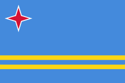
Aruba, officially the Country of Aruba (Land Aruba; Pais Aruba), is a constituent country of the Kingdom of the Netherlands physically located in the mid-south of the Caribbean Sea, about 29 km north of the Venezuela peninsula of Paraguaná and 80 km northwest of Curaçao. It measures 32 km long from its northwestern to its southeastern end and 10 km across at its widest point. Together with Bonaire and Curaçao, Aruba forms a group referred to as the ABC islands. Collectively, these and the other three Dutch substantial islands in the Caribbean are often called the Dutch Caribbean, of which Aruba has about one-third of the population. In 1986, it became a constituent country within the Kingdom of the Netherlands, and acquired the formal name the Country of Aruba.
Aruba is one of the four countries that form the Kingdom of the Netherlands, along with the Netherlands, Curaçao, and Sint Maarten; the citizens of these countries are all Dutch nationals. Aruba has no administrative subdivisions, but, for census purposes, is divided into eight regions. Its capital is Oranjestad. Unlike much of the Caribbean region, Aruba has a dry climate and an arid, cactus-strewn landscape. The relatively warm and sunny weather, and the climate allow for related tourism activities all year round. Its area is 179 km2 and it is quite densely populated, with 108,166 inhabitants per the 2020 census.