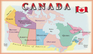
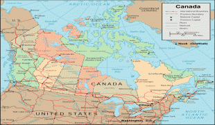
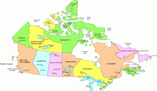
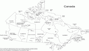
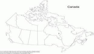
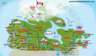
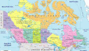
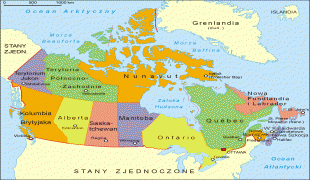
Canada
 |
 |
| Flag of Canada | |
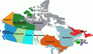
Indigenous peoples have continuously inhabited what is now Canada for thousands of years. Beginning in the 16th century, British and French expeditions explored and later settled along the Atlantic coast. As a consequence of various armed conflicts, France ceded nearly all of its colonies in North America in 1763. In 1867, with the union of three British North American colonies through Confederation, Canada was formed as a federal dominion of four provinces. This began an accretion of provinces and territories and a process of increasing autonomy from the United Kingdom. This widening autonomy was highlighted by the Statute of Westminster 1931 and culminated in the Canada Act 1982, which severed the vestiges of legal dependence on the Parliament of the United Kingdom.
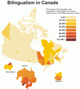
Canada is a parliamentary democracy and a constitutional monarchy in the Westminster tradition. The country's head of government is the prime minister, who holds office by virtue of their ability to command the confidence of the elected House of Commons, and is appointed by the governor general, representing the monarch of Canada, the head of state. The country is a Commonwealth realm and is officially bilingual (English and French) at the federal level. It ranks among the highest in international measurements of government transparency, civil liberties, quality of life, economic freedom, education, gender equality and environmental sustainability. It is one of the world's most ethnically diverse and multicultural nations, the product of large-scale immigration. Canada's long and complex relationship with the United States has had a significant impact on its economy and culture.
A highly developed country, Canada has the 24th highest nominal per capita income globally and the fifteenth-highest ranking on the Human Development Index. Its advanced economy is the eighth-largest in the world, relying chiefly upon its abundant natural resources and well-developed international trade networks. Canada is part of several major international and intergovernmental institutions or groupings including the United Nations, NATO, G7, Group of Ten, G20, Organisation for Economic Co-operation and Development (OECD), World Trade Organization (WTO), Commonwealth of Nations, Arctic Council, Organisation internationale de la Francophonie, Asia-Pacific Economic Cooperation forum, and Organization of American States.
While a variety of theories have been postulated for the etymological origins of Canada, the name is now accepted as coming from the St. Lawrence Iroquoian word kanata, meaning "village" or "settlement". In 1535, Indigenous inhabitants of the present-day Quebec City region used the word to direct French explorer Jacques Cartier to the village of Stadacona. Cartier later used the word Canada to refer not only to that particular village but to the entire area subject to Donnacona (the chief at Stadacona); by 1545, European books and maps had begun referring to this small region along the Saint Lawrence River as Canada.
From the 16th to the early 18th century, "Canada" referred to the part of New France that lay along the Saint Lawrence River. In 1791, the area became two British colonies called Upper Canada and Lower Canada. These two colonies were collectively named the Canadas until their union as the British Province of Canada in 1841.
Upon Confederation in 1867, Canada was adopted as the legal name for the new country at the London Conference, and the word Dominion was conferred as the country's title. By the 1950s, the term Dominion of Canada was no longer used by the United Kingdom, which considered Canada a "Realm of the Commonwealth". The government of Louis St. Laurent ended the practice of using Dominion in the statutes of Canada in 1951.
The Canada Act 1982, which brought the constitution of Canada fully under Canadian control, referred only to Canada. Later that year, the name of the national holiday was changed from Dominion Day to Canada Day. The term Dominion was used to distinguish the federal government from the provinces, though after the Second World War the term federal had replaced dominion.
Currency / Language
| ISO | Currency | Symbol | Significant figures |
|---|---|---|---|
| CAD | Canadian dollar | $ | 2 |
| ISO | Language |
|---|---|
| EN | English language |
| FR | French language |
| IU | Inuktitut |