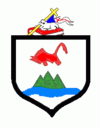
Cayey (Cayey Municipio)
 |
 |
Cayey is notable for its surrounding mountains. The city has been actively growing since the 1990s, evidenced by its designation as a Metropolitan Area by the U.S. Census Bureau. It has experienced significant growth in commerce, and many major retailers, such as Wal-Mart have opened stores in the city. Industries in Cayey include sugar, tobacco and poultry. For tobacco there is a well-known company called Consolidated Cigar Corp. A new coliseum and hospital facilities have also been built. Coca-Cola is a major corporation that has a manufacturing facility in the town. Cayey is also host to one of the campuses of the University of Puerto Rico, the University of Puerto Rico at Cayey.
Cayey was founded on August 17, 1773, by Juan Mata Vázquez, who became its first mayor. It is popularly said that Cayey derives its name from the Taino Indian word for "a place of waters". It was named Cayey de Muesas in honor of Miguel de Muesas, the then governor of Puerto Rico. The town is located in a valley nestled between Puerto Rico's Cordillera Central mountain range and the Sierra de Cayey at roughly the midpoint of routes PR-1 and PR-52. The routes lead to a popular drive that provides panoramic views of the island from its highest points.
Puerto Rico was ceded by Spain in the aftermath of the Spanish–American War under the terms of the Treaty of Paris of 1898 and became a territory of the United States. In 1899, the United States Department of War conducted a census of Puerto Rico finding that the population of Cayey was 14,442.
An education base began in the early to mid-1950s when the Interamerican University opened a branch in Cayey providing teacher training through a night class scheme. In 1967 the University of Puerto Rico opened a campus in the former Henry Barracks Military Reservation, and in the early 1980s El Turabo University, subsidiary of the Ana G. Mendez conglomerate opened a campus in the old tobacco factory at the entrance of town. The Interamerican University will be opening a Graduate campus in front of the main town square (downtown), and there are conversations with a foreign educational concern to open a technology campus using the buildings left over by the Gordonshire Knitting Mills. There are three major private schools: Radians School, the long established Colegio de Nuestra Senora de la Merced and La Milagrosa School. Cayey's health care base expanded in the mid-1960s with the Mennonite Medical Center and a Municipal Hospital along with laboratories, and urgent care centers that cater to the poor and the elderly.
With the construction of the Interstate (PR-52), Cayey has evolved into a "bedroom community" with gated housing developments, located just 30 minutes away from San Juan and 45 minutes away from Ponce. With pleasant weather and good private schools, Cayey has become a premium location for the affluent.
Hurricane Maria on September 20, 2017, triggered numerous landslides in Cayey with significant amount of rain and wind. The hurricane destroyed 3,000 homes in Cayey.
Map - Cayey (Cayey Municipio)
Map
Country - Puerto Rico
 |
 |
Currency / Language
| ISO | Currency | Symbol | Significant figures |
|---|---|---|---|
| USD | United States dollar | $ | 2 |
| ISO | Language |
|---|---|
| EN | English language |
| ES | Spanish language |


