Cayo District (Cayo District)
Being the largest district, it borders Guatemala to the west, Orange Walk district to the north, Belize district to the northeast, Stann Creek district to the southeast and Toledo district to the south. The nation's capital, Belmopan, is located within the district.
Other important towns and cities in the district include Benque Viejo del Carmen, twin towns of San Ignacio and Santa Elena (District's Capital), Seven Miles (El Progreso), San Antonio, Valley of Peace, St. Margaret, Roaring Creek, Armenia, San Jose Succotz, Arenal, Buena Vista, Bullet Tree Falls, Calla Creek, Esperanza, Cristo Rey, Georgeville, Unitedville, Blackman Eddy, Ontario, Camalote, Los Tambos, More Tomorrow and Spanish Lookout.
Major rivers in the district include the Macal River and the Mopan River.
Map - Cayo District (Cayo District)
Map
Country - Belize
 |
 |
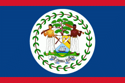
| Flag of Belize | |
The Maya civilization spread into the area of Belize between 1500 BC and AD 300 and flourished until about 1200. European contact began in 1492 when Christopher Columbus sailed along the Gulf of Honduras. European exploration was begun by English settlers in 1638. Spain and Britain both laid claim to the land until Britain defeated the Spanish in the Battle of St. George's Caye (1798). In 1840 it became a British colony known as British Honduras, and a Crown colony in 1862. Belize achieved its independence from the United Kingdom on 21 September 1981. It is the only mainland Central American country which is a Commonwealth realm, with King Charles III as its monarch and head of state, represented by a governor-general.
Currency / Language
| ISO | Currency | Symbol | Significant figures |
|---|---|---|---|
| BZD | Belize dollar | $ | 2 |
| ISO | Language |
|---|---|
| EN | English language |
| ES | Spanish language |


