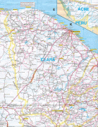
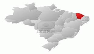
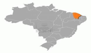
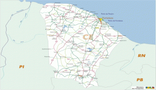
Ceará
 |
Literally, the name Ceará means "sings the jandaia". According to José de Alencar, one of the most important writers of Brazil and an authority in Tupi Guaraní, Ceará means turquoise or green waters.
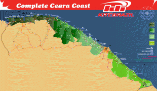
The state is best known for its extensive coastline, with 600 km of sand. There are also mountains and valleys producing tropical fruits. To the south, on the border of Paraíba, Pernambuco and Piauí, is the National Forest of Araripe.
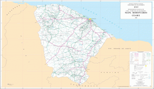
Ceará has an area of 148016 km2. It is bounded on the north by the Atlantic Ocean, on the east by the states of Rio Grande do Norte and Paraíba, on the south by Pernambuco state, and on the west by Piauí.
Ceará lies partly upon the northeast slope of the Brazilian Highlands, and partly upon the sandy coastal plain. Its surface is a succession of great terraces, facing north and northeast, formed by the denudation of the ancient sandstone plateau which once covered this part of the continent; the terraces are seamed by watercourses, and their valleys are broken by hills and ranges of highlands. The latter are the remains of the ancient plateau, capped with horizontal strata of sandstone, with a uniform altitude of 2000 to 2400 ft. The flat top of such a range is called a chapada or taboleira, and its width in places is from 32 to 56 mi. The boundary line with Piauí follows one of these ranges, the Serra de Ibiapaba, which unites with another range on the southern boundary of the state, known as the Serra do Araripe. Another range, or escarpment, crosses the state from east to west, but is broken into two principal divisions, each having several local names. These ranges are not continuous, the breaking down of the ancient plateau having been irregular and uneven.
The rivers of the state are small and, with one or two exceptions, become completely dry in the dry season. The largest is the Jaguaribe, which flows entirely across the state in a northeast direction.
Ceará has a varied environment, with mangroves, caatinga, jungle, scrubland and tropical forest. The higher ranges intercept considerable moisture from the prevailing trade winds, and their flanks and valleys are covered with a tropical forest which is typical of the region, gathering species from tropical forests, caatinga and cerrado. The less elevated areas of the plateaus are either thinly wooded or open campo. Most of the region at the lower altitudes is characterized by scrubby forests called caatingas, which is an endemic Brazilian vegetation. The sandy, coastal plain, with a width of 12 to 18 mi, is nearly bare of vegetation, although the coast has many enclaves of restingas (coastal forests) and mangroves.
The soil is, in general, thin and porous and does not retain moisture; consequently, the long dry season turns the country into a barren desert, relieved only by vegetation along the riverways and mountain ranges, and by the hardy, widely distributed Carnauba Palm (Copernicia cerifera), which in places forms groves of considerable extent. Some areas in the higher ranges of Serra da Ibiapaba, Serra do Araripe and others are more appropriate for agriculture, as their soil and vegetation are less affected by the dry seasons.
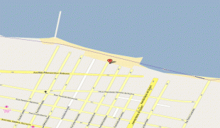
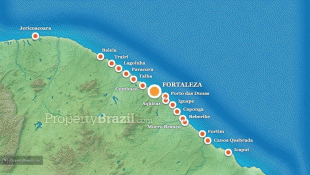
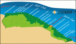
The beaches of the state are a major tourist attraction. Ceará has several famous beaches such as Canoa Quebrada, Jericoacoara, Morro Branco, Taíba and Flexeiras. The beaches are divided into two groups (in relation to the capital Fortaleza): Sunset Coast (Costa do Sol poente) and Sunrise Coast (Costa do Sol nascente).
Ceará lies in one of the few regions of the country that experiences earthquakes. In 1980 an earthquake measuring 5.8 on the Richter scale struck near Quixeramobim in the center of the state, rattling the city of Fortaleza but causing no injuries.
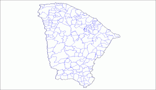
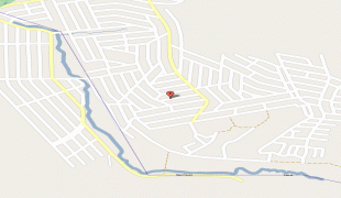
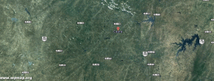
Map - Ceará
Map


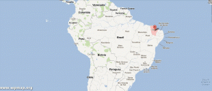
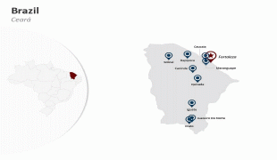
Country - Brazil


Currency / Language
| ISO | Currency | Symbol | Significant figures |
|---|---|---|---|
| BRL | Brazilian real | R$ | 2 |
| ISO | Language |
|---|---|
| EN | English language |
| FR | French language |
| PT | Portuguese language |
| ES | Spanish language |


