Central Serbia (Central Serbia)
Central Serbia takes up, roughly, the territory of Serbia between the natural borders consisting of the Danube and Sava (in the north), the Drina (in the west), and the "unnatural" border to the southwest with Montenegro, south with Kosovo and North Macedonia, and to the east with Bulgaria, with a small strip of the Danube with Romania in the northeast. The Danube and Sava divides central Serbia from the Serbian province of Vojvodina, while the Drina divides Serbia from Bosnia and Herzegovina. The Great Morava, a major river, goes through central Serbia. Extensions of three major mountain chains are located within Serbia proper: Dinaric Alps in the west and south, and the Carpathians and Balkan Mountains in the east.
Some notable geographical regions located in central Serbia are: Šumadija, Mačva, the Timok Valley (including the Negotin Valley), Pomoravlje, Podunavlje, Posavina, Podrinje, Zlatibor and Raška.
Map - Central Serbia (Central Serbia)
Map


Country - Serbia
 |
 |
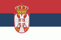
| Flag of Serbia | |
Continuously inhabited since the Paleolithic Age, the territory of modern-day Serbia faced Slavic migrations in the 6th century, establishing several regional states in the early Middle Ages at times recognised as tributaries to the Byzantine, Frankish and Hungarian kingdoms. The Serbian Kingdom obtained recognition by the Holy See and Constantinople in 1217, reaching its territorial apex in 1346 as the Serbian Empire. By the mid-16th century, the Ottomans annexed the entirety of modern-day Serbia; their rule was at times interrupted by the Habsburg Empire, which began expanding towards Central Serbia from the end of the 17th century while maintaining a foothold in Vojvodina. In the early 19th century, the Serbian Revolution established the nation-state as the region's first constitutional monarchy, which subsequently expanded its territory. Following casualties in World War I, and the subsequent unification of the former Habsburg crownland of Vojvodina with Serbia, the country co-founded Yugoslavia with other South Slavic nations, which would exist in various political formations until the Yugoslav Wars of the 1990s. During the breakup of Yugoslavia, Serbia formed a union with Montenegro, which was peacefully dissolved in 2006, restoring Serbia's independence as a sovereign state for the first time since 1918. In 2008, representatives of the Assembly of Kosovo unilaterally declared independence, with mixed responses from the international community while Serbia continues to claim it as part of its own sovereign territory.
Currency / Language
| ISO | Currency | Symbol | Significant figures |
|---|---|---|---|
| RSD | Serbian dinar | дин or din. | 2 |
| ISO | Language |
|---|---|
| BS | Bosnian language |
| HU | Hungarian language |
| SR | Serbian language |
