Chalan Pago-Ordot (Chalan Pago-Ordot Village)
Chalan Pago-Ordot (Chålan Pågu-Otdot) is a village in the United States territory of Guam, containing the communities of Chalan Pago and Ordot. It is located in the eastern-central part of the island and is part of the Kattan (Eastern) District. The village's population has increased slightly since the island's 2010 census.
Pågu is the Chamorro word for the wild tree Hibiscus tiliaceus, while "chålan"' means "road". The name Chalan Pago is named after the path from Hagåtña to the Spanish village at Pago Bay. Ordot comes from the word otdot, or ant.
In World War II, the Japanese used the area as a supply depot during their occupation of the island. Ordot is also the site of the controversial Ordot Landfill, first constructed by the U.S. Navy in the 1940s, but now full and in violation of United States Environmental Protection Agency (EPA) regulations. It was added to the National Priorities List in 1983 by the EPA, with the Navy as a potential contributor to it. The landfill was forced closed in 2011 and Guam agreed to pay for remediation of the surrounding area atop implemented a cap on the landfill from a prior 2004 consent decree. Guam had been able to successfully initiate action to recover a portion of the estimated US$160 million costs for this cleanup from the US government as a result of the Supreme Court case Guam v. United States in 2021.
Map - Chalan Pago-Ordot (Chalan Pago-Ordot Village)
Map
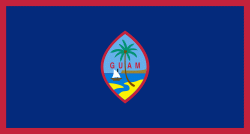
Country - Guam
 |
 |
People born on Guam are American citizens but are politically disenfranchised, having no vote in the United States presidential elections while residing on Guam. Guam delegates to the United States House of Representatives have no vote on the floor. Indigenous Guamanians are the Chamoru, historically known as the Chamorro, who are related to the Austronesian peoples of Malay archipelago, the Philippines, Taiwan, and Polynesia. But unlike most of its neighbors, Chamorro language is not classified as a Micronesian or Polynesian language. Rather, like Palauan, it possibly constitutes an independent branch of the Malayo-Polynesian language family. As of 2022, Guam's population is 168,801. Chamorros are the largest ethnic group, but a minority on the multi-ethnic island. The territory spans 210 mi2 and has a population density of 775 /mi2. The Chamorro people settled the island approximately 3,500 years ago. Portuguese explorer Ferdinand Magellan, while in the service of Spain, was the first European to visit the island on March 6, 1521. Guam was colonized by Spain in 1668. Between the 16th and 18th centuries, Guam was an important stopover for the Spanish Manila Galleons. During the Spanish–American War, the United States captured Guam on June 21, 1898. Under the 1898 Treaty of Paris, Spain ceded Guam to the U.S. effective April 11, 1899.
Currency / Language
| ISO | Currency | Symbol | Significant figures |
|---|---|---|---|
| USD | United States dollar | $ | 2 |
| ISO | Language |
|---|---|
| CH | Chamorro language |
| EN | English language |


