Chatham Islands (Chatham Islands)
The islands were uninhabited when the Moriori people arrived around 1500 CE and developed a peaceful way of life. In 1835 members of the Ngāti Mutunga and Ngāti Tama Māori iwi from the North Island of New Zealand invaded the islands and nearly exterminated the Moriori, enslaving the survivors. Later during the period of European colonisation of New Zealand, the New Zealand Company claimed that the British Crown had never included the Chatham Islands as being under its control. The company proposed that it should be sold to the Germans to be a German colony with a contract drawn up for the sale of the Islands of £10,000 in 1841. However, the sale failed and the Chatham Islands officially became part of the Colony of New Zealand in 1842. In 1863 the resident magistrate declared the Moriori released from slavery.
The Chatham Islands had a resident population of Waitangi is the main port and settlement. The local economy depends largely on conservation, tourism, farming, and fishing. The Chatham Islands Council provides local administration – its powers resemble those of New Zealand's unitary authorities. The Chatham Islands have their own time zone, 45 minutes ahead of the rest of New Zealand.
The islands lie roughly 840 km east of Christchurch, New Zealand. The nearest New Zealand mainland point to the Chatham Islands, Cape Turnagain in the North Island, is 650 km distant. The two largest islands, Chatham Island and Pitt Island (Rangiauria), constitute most of the total area of 793.87 km2, with a dozen scattered islets making up the rest.
The islands sit on the Chatham Rise, a large, relatively shallowly submerged (no more than 1000 m deep at any point) part of the Zealandia continent that stretches east from near the South Island. The Chatham Islands, which emerged only within the last four million years, are the only part of the Chatham Rise showing above sea level.
The islands are hilly, with coastal areas including cliffs, dunes, beaches, and lagoons. Pitt is more rugged than Chatham; its highest point (299 m) is on a plateau near the southernmost point of the main island, 1.5 km south of Lake Te Rangatapu. The plateau is dotted with numerous lakes and lagoons, flowing mainly from the island's nearby second-highest point, Maungatere Hill, at 294 m. Notable are the large Te Whanga Lagoon, and Huro and Rangitahi. Chatham has a number of streams, including Te Awainanga and Tuku.
Chatham and Pitt are the only inhabited islands; the remaining smaller islands function as conservation reserves with restricted or prohibited access. The livelihoods of the inhabitants depend on agriculture - the islands export coldwater crayfish - and, increasingly, on tourism.
The names of the main islands, in the order of occupation are:
Map - Chatham Islands (Chatham Islands)
Map
Country - New_Zealand
 |
 |
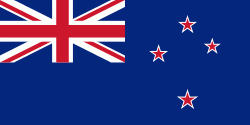
| Flag of New Zealand | |
The islands of New Zealand were the last large habitable land to be settled by humans. Between about 1280 and 1350, Polynesians began to settle in the islands and then developed a distinctive Māori culture. In 1642, the Dutch explorer Abel Tasman became the first European to sight and record New Zealand. In 1840, representatives of the United Kingdom and Māori chiefs signed the Treaty of Waitangi, which in its English version declared British sovereignty over the islands. In 1841, New Zealand became a colony within the British Empire. Subsequently, a series of conflicts between the colonial government and Māori tribes resulted in the alienation and confiscation of large amounts of Māori land. New Zealand became a dominion in 1907; it gained full statutory independence in 1947, retaining the monarch as head of state. Today, the majority of New Zealand's population of 5.1 million is of European descent; the indigenous Māori are the largest minority, followed by Asians and Pacific Islanders. Reflecting this, New Zealand's culture is mainly derived from Māori and early British settlers, with recent broadening of culture arising from increased immigration. The official languages are English, Māori, and New Zealand Sign Language, with the local dialect of English being dominant.
Currency / Language
| ISO | Currency | Symbol | Significant figures |
|---|---|---|---|
| NZD | New Zealand dollar | $ | 2 |
| ISO | Language |
|---|---|
| EN | English language |


