Map - Coclé Province (Provincia de Coclé)

Coclé Province (Provincia de Coclé)
Coclé is a province of central Panama on the nation's southern coast. The administrative capital is the city of Penonomé. This province was created by the Act of September 12, 1855 with the title of Department of Coclé during the presidency of Dr. Justo de Arosemena. It became a province, Decretory Number 190, on October 20, 1985. Coclé is primarily an agricultural area, with sugar and tomatoes as major crops. The province has a number of well-known beaches, such as Santa Clara, Farallon and Rio Hato, and tourist activity has increased in recent years. It covers an area of 4,946.6 sq.km, and had a population of 265,149 in 2019.

During pre-Columbian times, the area of Panama which today includes Coclé province had a number of identifiable native cultures. Archaeologists have loosely designated these cultures by pottery style. The poorly studied La Mula period ranged from 150 BC to AD 300. It was followed by the Tonosi period, from AD 300 to AD 550, and by the Cubita period, from AD 550 to AD 700. A unified Indigenous culture appears to have flourished in this area from approximately 1200 BC until the 16th century.
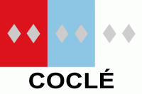
 
Map - Coclé Province (Provincia de Coclé)
Map
Google Earth - Map - Coclé Province
Google Earth
Openstreetmap - Map - Coclé Province
Openstreetmap
Map - Coclé Province - Esri.WorldImagery
Esri.WorldImagery
Map - Coclé Province - Esri.WorldStreetMap
Esri.WorldStreetMap
Map - Coclé Province - OpenStreetMap.Mapnik
OpenStreetMap.Mapnik
Map - Coclé Province - OpenStreetMap.HOT
OpenStreetMap.HOT
Map - Coclé Province - CartoDB.Positron
CartoDB.Positron
Map - Coclé Province - CartoDB.Voyager
CartoDB.Voyager
Map - Coclé Province - OpenMapSurfer.Roads
OpenMapSurfer.Roads
Map - Coclé Province - Esri.WorldTopoMap
Esri.WorldTopoMap
Map - Coclé Province - Stamen.TonerLite
Stamen.TonerLite
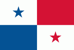
Country - Panama
Flag of Panama
Panama (, ; Panamá ), officially the Republic of Panama (República de Panamá), is a transcontinental country spanning the southern part of North America and the northern part of South America. It is bordered by Costa Rica to the west, Colombia to the southeast, the Caribbean Sea to the north, and the Pacific Ocean to the south. Its capital and largest city is Panama City, whose metropolitan area is home to nearly half the country's million people.

Panama was inhabited by indigenous tribes before Spanish colonists arrived in the 16th century. It broke away from Spain in 1821 and joined the Republic of Gran Colombia, a union of Nueva Granada, Ecuador, and Venezuela. After Gran Colombia dissolved in 1831, Panama and Nueva Granada eventually became the Republic of Colombia. With the backing of the United States, Panama seceded from Colombia in 1903, allowing the construction of the Panama Canal to be completed by the United States Army Corps of Engineers between 1904 and 1914. The 1977 Torrijos–Carter Treaties agreed to transfer the canal from the United States to Panama on December 31, 1999. The surrounding territory was first returned in 1979.
Currency / Language  
ISO Currency Symbol Significant figures
PAB Panamanian balboa B/ 2
USD United States dollar $ 2
Neighbourhood - Country  
  •  Costa rica 
  •  Colombia