Cook Islands (Cook Islands)
 |
 |
Since 2001, the Cook Islands has run its own foreign and defence policy. In recent decades, the Cook Islands have adopted an increasingly assertive foreign policy, and a Cook Islander, Henry Puna, currently serves as Secretary General of the Pacific Islands Forum. Most Cook Islanders are citizens of New Zealand, but they also have the status of Cook Islands nationals, which is not given to other New Zealand citizens. The Cook Islands have been an active member of the Pacific Community since 1980.
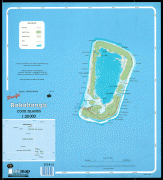
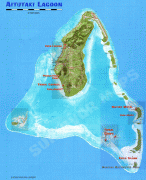
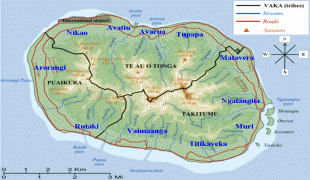
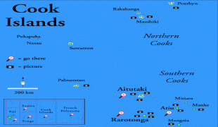
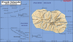
The Cook Islands' main population centres are on the island of Rarotonga (10,898 in 2021), where there is an international airport. The census of 2021 put the total population at 15,040. There is also a larger population of Cook Islanders in New Zealand and Australia: in the 2018 New Zealand census, 80,532 people said they were Cook Islanders, or of Cook Islands descent. The last Australian census recorded 28,000 Cook Islanders living in Australia, many with Australian citizenship.
With over 168,000 visitors travelling to the islands in 2018, tourism is the country's main industry, and the leading element of the economy, ahead of offshore banking, pearls, and marine and fruit exports.
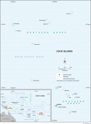
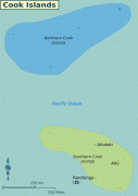
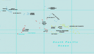
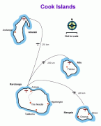
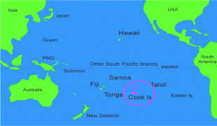
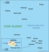
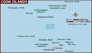
The Cook Islands comprise 15 islands split between two island groups, which have carried individual names in indigenous languages including Cook Islands Māori and Pukapukan throughout the time they have been inhabited. The first name given by Europeans was Gente Hermosa (beautiful people) by Spanish explorers to Rakahanga in 1606.
The islands as a whole are named after British Captain James Cook, who visited during the 1770s and named Manuae "Hervey Island" after Augustus Hervey, 3rd Earl of Bristol. The southern island group became known as the "Hervey Islands" after this. In the 1820s, Russian Admiral Adam Johann von Krusenstern referred to the southern islands as the "Cook Islands" in his Atlas de l'Ocean Pacifique. The entire territory (including the northern island group) was not known as the "Cook Islands" until after its annexation by New Zealand in the early 20th century. In 1901, the New Zealand parliament passed the Cook and other Islands Government Act, demonstrating that the name "Cook Islands" only referred to some of the islands. However, this situation had changed by the passage of the Cook Islands Act 1915, which defined the Cooks' area and included all presently included islands.
The islands' official name in Cook Islands Māori is Kūki 'Āirani, a transliteration of the English name.