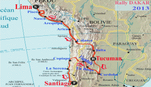
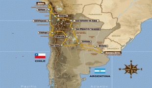
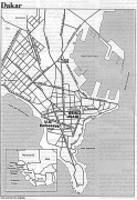
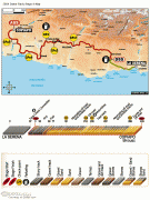
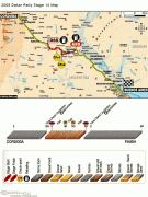
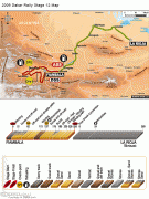
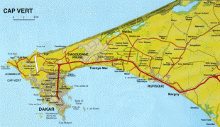
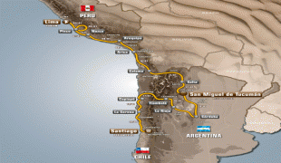
Dakar
 |
The area around Dakar was colonized in the 15th century. The Portuguese established a presence on the island of Gorée off the coast of Cap-Vert and used it as a base for the Atlantic slave trade. France took over the island in 1677. Following the abolition of the slave trade and French annexation of the mainland area in the 19th century, Dakar grew into a major regional port and a major city of the French colonial empire. In 1902, Dakar replaced Saint-Louis as the capital of French West Africa. From 1959 to 1960, Dakar was the capital of the short-lived Mali Federation. In 1960, it became the capital of the independent Republic of Senegal.
The Cap-Vert peninsula was settled no later than the 15th century, by the Lebu people, an aquacultural subgroup of the Wolof ethnic group. The original villages—Ouakam, Ngor, Yoff and Hann—still constitute distinctively Lebou neighborhoods of the city today. In 1444, the Portuguese reached the Bay of Dakar, initially as slave-raiders. Peaceful contact was finally opened in 1456 by Diogo Gomes, and the bay was subsequently referred to as the "Angra de Bezeguiche" (after the name of the local ruler). The bay of "Bezeguiche" would go on to serve as a critical stop for the Portuguese India Armadas of the early 16th century, where large fleets would routinely stop, both on their outward and return journeys from India, to repair, collect fresh water from the rivulets and wells along the Cap-Vert shore and trade for provisions with the local people for their remaining voyage. (It was famously during one of these stops, in 1501, where the Florentine navigator Amerigo Vespucci began to construct his "New World" hypothesis about America. )
The Portuguese eventually founded a settlement on the island of Gorée (then known as the island of Bezeguiche or Palma), which by 1536 they began to use as a base for slave exportation. The mainland of Cap-Vert, however, was under control of the Jolof Empire, as part of the western province of Cayor which seceded from Jolof in its own right in 1549. A new Lebou village, called Ndakaaru, was established directly across from Gorée in the 17th century to service the European trading factory with food and drinking water. Gorée was captured by the United Netherlands in 1588, which gave it its present name (spelled Goeree, after Goeree-Overflakkee in the Netherlands). The island was to switch hands between the Portuguese and Dutch several more times before falling to the English under Admiral Robert Holmes on January 23, 1664, and finally to the French in 1677. Though under continuous French administration since, métis families, descended from Dutch and French traders and African wives, dominated the slave trade. The infamous "House of Slaves" was built at Gorée in 1776.
In 1795, the Lebou of Cape Verde revolted against Cayor rule. A new theocratic state, subsequently called the "Lebou Republic" by the French, was established under the leadership of the Diop, a Muslim clerical family originally from Koki in Cayor. The capital of the republic was established at Ndakaaru. In 1857 the French established a military post at Ndakaaru (which they called "Dakar") and annexed the Lebou Republic, though its institutions continued to function nominally. The Serigne (also spelled Sëriñ, "Lord") of Ndakaaru is still recognized as the traditional political authority of the Lebou by the Senegalese State today.
The slave trade was abolished by France in February 1794. However, Napoleon reinstated it in May 1802, then finally abolished it permanently in March 1815. Despite Napoleon's abolition, a clandestine slave trade continued at Gorée until 1848, when it was abolished throughout all French territories. To replace trade in slaves, the French promoted peanut cultivation on the mainland. As the peanut trade boomed, tiny Gorée Island, whose population had grown to 6,000 residents, proved ineffectual as a port. Traders from Gorée decided to move to the mainland and a "factory" with warehouses was established in Rufisque in 1840.
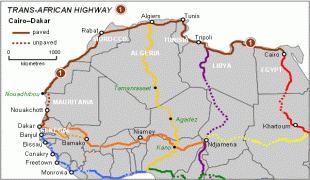
Large public expenditure for infrastructure was allocated by the colonial authorities to Dakar's development. The port facilities were improved with jetties, a telegraph line was established along the coast to Saint-Louis and the Dakar-Saint-Louis railway was completed in 1885, at which point the city became an important base for the conquest of the Western Sudan.
Gorée, including Dakar, was recognised as a French commune in 1872. Dakar itself was split off from Gorée as a separate commune in 1887. The citizens of the city elected their own mayor and municipal council and helped send an elected representative to the National Assembly in Paris. Dakar replaced Saint-Louis as the capital of French West Africa in 1902. A second major railroad, the Dakar-Niger built from 1906 to 1923, linked Dakar to Bamako and consolidated the city's position at the head of France's West African empire. In 1929, the commune of Gorée Island, now with only a few hundred inhabitants, was merged into Dakar.
Urbanization during the colonial period was marked by forms of racial and social segregation—often expressed in terms of health and hygiene—which continue to structure the city today. Following a plague epidemic in 1914, the authorities forced most of the African population out of old neighborhoods, or "Plateau", and into a new quarter, called Médina, separated from it by a "sanitary cordon". As first occupants of the land, the Lebou inhabitants of the city successfully resisted this expropriation. They were supported by Blaise Diagne, the first African to be elected Deputy to the National Assembly. Nonetheless, the Plateau thereafter became an administrative, commercial, and residential district increasingly reserved for Europeans and served as model for similar exclusionary administrative enclaves in French Africa's other colonial capitals (Bamako, Conakry, Abidjan, Brazzaville). Meanwhile, the Layene Sufi order, established by Seydina Mouhammadou Limamou Laye, was thriving among the Lebou in Yoff and in a new village called Cambérène. Since independence, urbanization has sprawled eastward past Pikine, a commuter suburb whose population (2001 est. 1,200,000) is greater than that of Dakar proper, to Rufisque, creating a conurbation of almost 3 million (over a quarter of the national population).
In its colonial heyday Dakar was one of the major cities of the French Empire, comparable to Hanoi or Beirut. French trading firms established branch offices there and industrial investments (mills, breweries, refineries, canneries) were attracted by its port and rail facilities. It was also strategically important to France, which maintained an important naval base and coaling station in its harbor and which integrated it into its earliest air force and airmail circuits, most notably with the legendary Mermoz airfield (no longer extant).
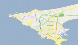
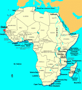
Map - Dakar
Map


Country - Senegal
 |
 |
| Flag of Senegal | |
Senegal is notably the westernmost country in the mainland of the Old World, or Afro-Eurasia. It owes its name to the Senegal River, which borders it to the east and north. The climate is typically Sahelian, though there is a rainy season. Senegal covers a land area of almost 197000 km2 and has a population of around million. The state is a unitary presidential republic; since the country's foundation in 1960, it has been recognized as one of the most stable countries on the African continent.
Currency / Language
| ISO | Currency | Symbol | Significant figures |
|---|---|---|---|
| XOF | West African CFA franc | Fr | 0 |
| ISO | Language |
|---|---|
| FR | French language |
| WO | Wolof language |