Farim (Farim Sector)
Farim is a town of northern Guinea-Bissau. It sits on the north bank of the Farim/Cacheu River, about 215 km (135 miles) up the river from Cacheu. Population 8,661 (2009 census).
Farim was founded about 1641 by the Captain-Major of Cacheu, who recruited lançados from Geba to move to where they would be less vulnerable to attack by African tribes. The name derived from farim, the title of the local Mandinka people's ruler. For their part, the Mandinkas and Soninke called the settlement Tubabodaga ("village of the whites"). It was well-situated as a port, since the river was continuously navigable by sailing vessels from Cacheu.
It became a presídio (garrisoned place) though an order dated 10 November 1696, in reaction to an anticipated attack from nearby Canico. The area remained generally peaceful, and the defenses gradually deteriorated.
It was a base for operations against Oio in 1897 and 1902. Farim started to grow in earnest in the 1910s, with over twenty trading firms based there, and became a vila (town) in 1918.
Farim had become a centro comercial by 1925, and experienced an influx of Lebanese and Syrian merchants, dealing in peanuts and timber. Its economy was hit hard by the independence struggle in the 1960s and 1970s.
Map - Farim (Farim Sector)
Map
Country - Guinea-Bissau
 |
 |
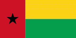
| Flag of Guinea-Bissau | |
Guinea-Bissau was once part of the kingdom of Kaabu, as well as part of the Mali Empire. Parts of this kingdom persisted until the 18th century, while a few others were under some rule by the Portuguese Empire since the 16th century. In the 19th century, it was colonised as Portuguese Guinea. Portuguese control was restricted and weak until the early 20th century with the pacification campaigns, these campaigns solidified Portuguese sovereignty in the area. The final Portuguese victory over the remaining bastion of mainland resistance, the Papel ruled Kingdom of Bissau in 1915 by the Portuguese military office Teixeira Pinto, and recruited Wolof mercenary Abdul Injai was the event to solidify mainland control. The Bissagos, islands off the coast of Guinea-Bissau, were officially conquered in 1936, ensuring Portuguese control of both the mainland and islands of the region. Upon independence, declared in 1973 and recognised in 1974, the name of its capital, Bissau, was added to the country's name to prevent confusion with Guinea (formerly French Guinea). Guinea-Bissau has a history of political instability since independence, and only one elected president (José Mário Vaz) has successfully served a full five-year term. The current president is Umaro Sissoco Embaló, who was elected on 29 December 2019.
Currency / Language
| ISO | Currency | Symbol | Significant figures |
|---|---|---|---|
| XOF | West African CFA franc | Fr | 0 |
| ISO | Language |
|---|---|
| PT | Portuguese language |


