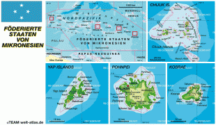
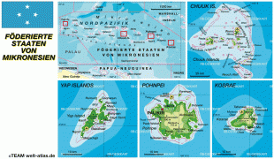
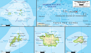
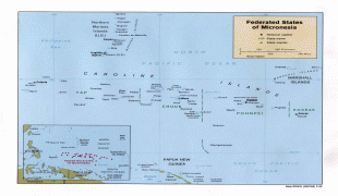
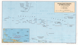
Federated States of Micronesia (Federated States of Micronesia)
 |
 |
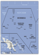
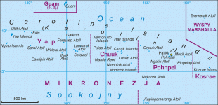
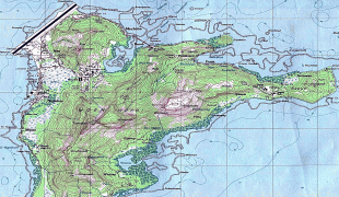
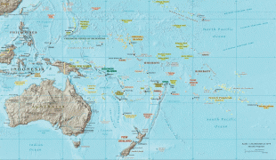
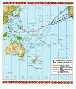
While the FSM's total land area is quite small, the country's waters occupy nearly 3 e6km2 of the Pacific Ocean, giving the country the 14th-largest exclusive economic zone in the world. The sovereign island nation's capital is Palikir, located on Pohnpei Island, while the largest city is Weno, located in the Chuuk Atoll.
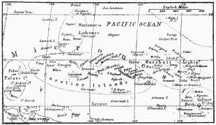
Each of its four states is centered on one or more main volcanic islands, and all but Kosrae include numerous outlying atolls. The Federated States of Micronesia is spread across part of the Caroline Islands in the wider region of Micronesia, which consists of thousands of small islands divided among several countries. The term Micronesia may refer to the Federated States or to the region as a whole.
The FSM was formerly a part of the Trust Territory of the Pacific Islands (TTPI), a United Nations Trust Territory under U.S. administration, but it formed its own constitutional government on May 10, 1979, becoming a sovereign state after independence was attained on November 3, 1986, under a Compact of Free Association with the United States. Other neighboring island entities, and also former members of the TTPI, formulated their own constitutional governments and became the Republic of the Marshall Islands (RMI) and the Republic of Palau (ROP). The FSM has a seat in the United Nations and has been a member of the Pacific Community since 1983.
The ancestors of the Micronesians settled over four thousand years ago. A decentralized chieftain-based system eventually evolved into a more centralized economic and religious culture centered on Yap Island.
Nan Madol, a UNESCO World Heritage Site, consisting of a series of small artificial islands linked by a network of canals, is often called the Venice of the Pacific. It is located on the eastern periphery of the island of Pohnpei and used to be the ceremonial and political seat of the Saudeleur dynasty that united Pohnpei's estimated 25,000 people from about AD 500 until 1500, when the centralized system collapsed.
European explorers—first the Portuguese in search of the Spice Islands (Indonesia) and then the Spanish—reached the Carolines in the sixteenth century. The Treaty of Tordesillas gave these lands to Spain and the Spanish incorporated the archipelago to the Spanish East Indies through the capital, Manila, and in the 19th century established a number of outposts and missions. In 1887, they founded the town of Santiago de la Ascensión in what today is Kolonia on the island of Pohnpei.
In the 1870s, Germany began extending its sphere of influence in the Caroline Islands, leading to the Carolines Question of 1885 in which Pope Leo XIII was asked to determine if Germany or Spain had authority over the islands. The result was a confirmation of Spanish authority over the islands, but Germany would have free access to the islands.
Following defeat in the Spanish–American War, the Spanish sold the archipelago to Germany in 1899 under the German–Spanish Treaty of 1899. Germany incorporated it into German New Guinea. (A few remote islands, notably Kapingamarangi, were not specifically named in the treaty, but this remained unnoticed until the late 1940s and, while acknowledging the historical curiosity in 1949, Spain has made no modern claims to the islands. )
During World War I, it was captured by Japan. Following the war, the League of Nations awarded a mandate for Japan to administer the islands as part of the South Seas Mandate.