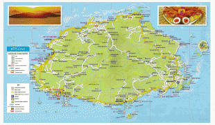
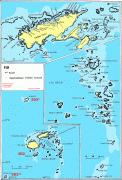
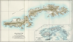
Fiji (Republic of Fiji)
 |
 |
| Flag of Fiji | |
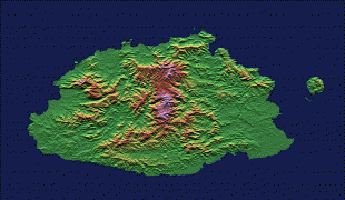
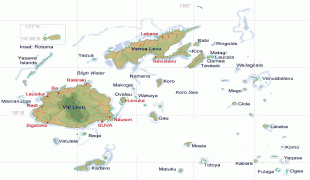
The majority of Fiji's islands were formed by volcanic activity starting around 150 million years ago. Some geothermal activity still occurs today on the islands of Vanua Levu and Taveuni. The geothermal systems on Viti Levu are non-volcanic in origin and have low-temperature surface discharges (of between roughly 35 and 60 C).
Humans have lived in Fiji since the second millennium BCE—first Austronesians and later Melanesians, with some Polynesian influences. Europeans first visited Fiji in the 17th century. In 1874, after a brief period in which Fiji was an independent kingdom, the British established the Colony of Fiji. Fiji operated as a Crown colony until 1970, when it gained independence and became known as the Dominion of Fiji. In 1987, following a series of coups d'état, the military government that had taken power declared it a republic. In a 2006 coup, Commodore Frank Bainimarama seized power. In 2009, the Fijian High Court ruled that the military leadership was unlawful. At that point, President Ratu Josefa Iloilo, whom the military had retained as the nominal head of state, formally abrogated the 1997 Constitution and re-appointed Bainimarama as interim prime minister. Later in 2009, Ratu Epeli Nailatikau succeeded Iloilo as president. On 17 September 2014, after years of delays, a democratic election took place. Bainimarama's FijiFirst party won 59.2% of the vote, and international observers deemed the election credible.
Fiji has one of the most developed economies in the Pacific through its abundant forest, mineral, and fish resources. The currency is the Fijian dollar, with the main sources of foreign exchange being the tourist industry, remittances from Fijians working abroad, bottled water exports, and sugar cane. The Ministry of Local Government and Urban Development supervises Fiji's local government, which takes the form of city and town councils.
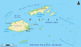
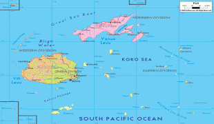
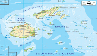
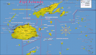
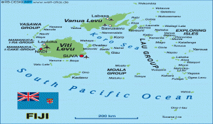
The name of Fiji's main island, Viti Levu, served as the origin of the name "Fiji", though the common English pronunciation is based on that of Fiji's island neighbours in Tonga. An official account of the emergence of the name states:
"Fijians first impressed themselves on European consciousness through the writings of the members of the expeditions of Cook who met them in Tonga. They were described as formidable warriors and ferocious cannibals, builders of the finest vessels in the Pacific, but not great sailors. They inspired awe amongst the Tongans, and all their Manufactures, especially bark cloth and clubs, were highly valued and much in demand. They called their home Viti, but the Tongans called it Fisi, and it was by this foreign pronunciation, Fiji, first promulgated by Captain James Cook, that these islands are now known."
"Feejee", the Anglicised spelling of the Tongan pronunciation, occurred in accounts and other writings by missionaries and other travellers visiting Fiji until the late-19th century.
Currency / Language
| ISO | Currency | Symbol | Significant figures |
|---|---|---|---|
| FJD | Fijian dollar | $ | 2 |
| ISO | Language |
|---|---|
| EN | English language |
| FJ | Fijian language |