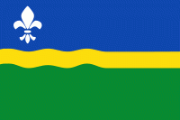
Flevoland is the twelfth and youngest province of the Netherlands, established in 1986, when the southern and eastern Flevopolders, together with the Noordoostpolder, were merged into one provincial entity. It is in the centre of the country in the former Zuiderzee, which was turned into the freshwater IJsselmeer by the closure of the Afsluitdijk in 1932. Almost all of the land belonging to Flevoland was reclaimed in the 1950s and 1960s while splitting the Markermeer and Bordering lakes from the IJsselmeer. As to dry land, it is the smallest province of the Netherlands at 1412 km2, but not gross land as that includes much of the waters of the fresh water lakes (meres) mentioned.
The province has a population of 423,021 as of January 2020 and consists of six municipalities. Its capital is Lelystad and its most populous city is Almere, which forms part of the Randstad and has grown to become the seventh largest city of the country. Flevoland is bordered in the extreme north by Friesland, in the northeast by Overijssel, and in the northwest by the lakes Markermeer and IJsselmeer. In the southeast, the province borders on Gelderland; in the southwest on Utrecht and North Holland. Outside urban areas, the land in Flevoland is predominantly used for agriculture.
Flevoland was named after Lacus Flevo, a name recorded in Roman sources for a large inland lake at the southern end of the later-formed Zuiderzee; it was mentioned by the Roman geographer Pomponius Mela in his De Chorographia in 44 AD. Due to the slowly rising sea level, a number of lakes gradually developed in the Zuiderzee region, which eventually became contiguous. Pomponius wrote about this: "The northern branch of the Rhine extends to Lake Flevo, which encloses an island of the same name and then flows to the sea like a normal river." Other sources speak of Flevum, which means 'flow'. The process continued and gradually the Zuiderzee arose from this lake. The names "Flevoland" and "Vlieland" have the same origin. Between 790 and 1250, Lake Flevo became connected with the North Sea. As a result, a number of villages were swallowed by the sea. The newly created inland sea was called Almere. The city of Almere is named after this lake.