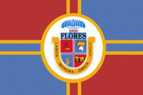
Flores Department (Departamento de Flores)
 |
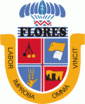 |
The department was formed in 1885 from part of San José Department, during the government of President Máximo Santos. It is named after the former Colorado Party leader, Venancio Flores, who was born in Trinidad in the nineteenth century.
The department has many sites of prehistoric rock art. Such examples of rock art are particularly concentrated at Chamangá (Localidad Rupestre de Chamangá).
Another site of interest is the Palace Cave.
Map - Flores Department (Departamento de Flores)
Map


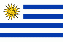
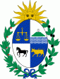
Country - Uruguay
 |
 |
| Flag of Uruguay | |
The area that became Uruguay was first inhabited by groups of hunter–gatherers 13,000 years ago. The predominant tribe at the moment of the arrival of Europeans was the Charrúa people, when the Portuguese first established Colónia do Sacramento in 1680; Uruguay was colonized by Europeans late relative to neighboring countries. The Spanish founded Montevideo as a military stronghold in the early 18th century because of the competing claims over the region. Uruguay won its independence between 1811 and 1828, following a four-way struggle between Portugal and Spain, and later Argentina and Brazil. It remained subject to foreign influence and intervention throughout the 19th century, with the military playing a recurring role in domestic politics. A series of economic crises and the political repression against left-wing guerrilla activity in the late 1960s and early 1970s put an end to a democratic period that had begun in the early 20th century, culminating in the 1973 coup d'état, which established a civic-military dictatorship. The military government persecuted leftists, socialists, and political opponents, resulting in deaths and numerous instances of torture by the military; the military relinquished power to a civilian government in 1985. Uruguay is today a democratic constitutional republic, with a president who serves as both head of state and head of government.
Currency / Language
| ISO | Currency | Symbol | Significant figures |
|---|---|---|---|
| UYU | Uruguayan peso | $ | 2 |
| ISO | Language |
|---|---|
| ES | Spanish language |