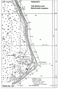
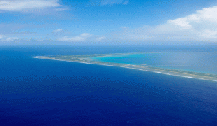
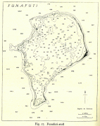
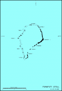
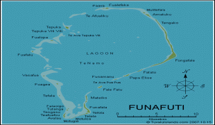
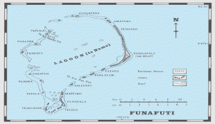
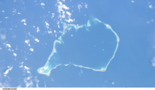
Funafuti
The capital of Tuvalu is sometimes said to be Fongafale or Vaiaku, but, officially, the entire atoll of Funafuti is its capital, since it has a single government that is responsible for the whole atoll.
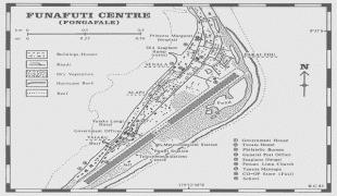
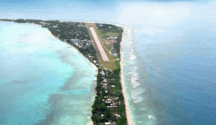
The largest island is Fongafale. The island houses four villages and community meeting places. The Funafuti Falekaupule is the local council, with the Kaupule as the executive of the Falekaupule. On Fongafale, the Funafuti Kaupule is responsible for approvals of the construction of houses or extension to an existing buildings on private land and the Lands Management Committee is the responsible authority in relation to lands leased by Government. The installed PV capacity in Funafuti in 2020 was 735 kW compared to 1800 kW of diesel (16% penetration).
Tausoa Lima Falekaupule is the traditional meeting house on Funafuti. Tausoalima means "hand of friendship" and Falekaupule means "traditional island meeting hall." There is the Funafuti Lagoon Hotel, and other guesthouses as well as homes, constructed both in the traditional manner, out of palm fronds, and more recently out of cement blocks. The most prominent building on Funafuti atoll is the Fētu'ao Lima (Morning Star Church) of the Church of Tuvalu.
Other sites of interest are the remains of Japanese aircraft that crashed on Funafuti during World War II. The airfield was constructed during World War II. It was adapted to serve as the Funafuti International Airport, which serves both as the airstrip for the flights from Fiji as well as providing a place for sporting and other recreational activities.
A major sporting event is the "Independence Day Sports Festival" held annually at Fongafale on 1 October. The most important sports event within the country is arguably the Tuvalu Games, which are held yearly since 2008, with teams coming to Funafuti from the outer islands to compete in the games. Football in Tuvalu is played at club and national team level. The Tuvalu national football team trains at the Tuvalu Sports Ground on Funafuti and competes in the Pacific Games and South Pacific Games.
The Parliament of Tuvalu or Palamene o Tuvalu is located on Fongafale, together with the offices of the government departments and the government agencies, including the Tuvalu Telecommunications Corporation, National Bank of Tuvalu, Tuvalu Philatelic Bureau, Tuvalu Meteorological Service, Tuvalu National Library and Archives and the Tuvalu Media Department that operates Radio Tuvalu. The police service has its headquarters and the jail on Fongafale. The High Court of Tuvalu is also located on Fongafale.
The Princess Margaret Hospital, the only hospital in Tuvalu, is located on Fongafale.
Map - Funafuti
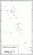
Map


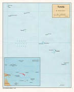
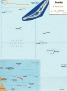

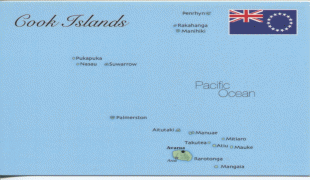

Country - Tuvalu
 |
 |
| Flag of Tuvalu | |
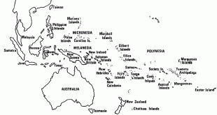
The first inhabitants of Tuvalu were Polynesians, according to well-established theories regarding a migration of Polynesians into the Pacific that began about three thousand years ago. Long before European contact with the Pacific islands, Polynesians frequently voyaged by canoe between the islands. Polynesian navigation skills enabled them to make elaborately planned journeys in either double-hulled sailing canoes or outrigger canoes. Scholars believe that the Polynesians spread out from Samoa and Tonga into the Tuvaluan atolls, which then served as a stepping stone for further migration into the Polynesian outliers in Melanesia and Micronesia.
Currency / Language
| ISO | Currency | Symbol | Significant figures |
|---|---|---|---|
| AUD | Australian dollar | $ | 2 |
| ISO | Language |
|---|---|
| EN | English language |
| SM | Samoan language |