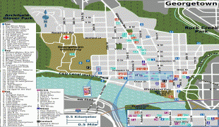
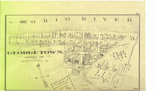
Georgetown (Georgetown)
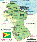
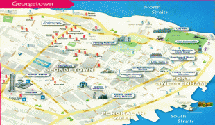
Georgetown (Jarjtown) is the capital and largest city of Guyana. It is situated in Demerara-Mahaica, region 4, on the Atlantic Ocean coast, at the mouth of the Demerara River. It is nicknamed the "Garden City of the Caribbean." It is the retail, administrative, and financial services centre of the country, and the city accounts for a large portion of Guyana's GDP. The city recorded a population of 118,363 in the 2012 census.
All executive departments of Guyana's government are located in the city, including Parliament Building, Guyana's Legislative Building and the Court of Appeals, Guyana's highest judicial court. The State House (the official residence of the head of state), as well as the offices and residence of the head of government, are both located in the city. The CARICOM headquarters is also based in Georgetown.
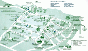
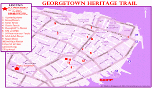
Georgetown is also known for its British colonial architecture, including the tall painted-timber St. George's Cathedral and the iconic Stabroek Market.
The city of Georgetown began as a small town in the 18th century. Originally, the capital of the Demerara-Essequibo colony was located on Borsselen Island in the Demerara River under the administration of the Dutch. When the colony was captured by the British in 1781, Lieutenant-Colonel Robert Kingston chose the mouth of the Demerara River for the establishment of a town which was situated between Plantations Werk-en-rust and Vlissengen.
It was the French who made it a capital city when they colonised it in 1782. The French called the capital Longchamps. When the town was restored to the Dutch in 1784, it was renamed Stabroek after Nicolaas Geelvinck, Lord of Stabroek, and president of the Dutch West India Company. Eventually the town expanded and covered the estates of Vlissengen, La Bourgade and Eve Leary to the North, and Werk-en-rust and La Repentir to the South.
It was renamed Georgetown on 29 April 1812 in honour of King George III. On 5 May 1812, an ordinance was passed to the effect that the town formerly called Stabroek, with districts extending from La Penitence to the bridges in Kingston and entering upon the road to the military camps, shall be called Georgetown.
The ordinance provided that the various districts of Georgetown shall be known by their own names. The supervision of Georgetown was to be done by a committee chosen by the governor and Court of Policy. Estimates of expenditure were to be prepared.
By 1806, the owner of Vlissingen asked to be exempted from the responsibility of maintaining the road which is now called Camp Street, but the Court refused the request. In 1810, the maintenance of the roads in the area called Georgetown cost 11,000 guilders per annum.
The governing body of Georgetown was once a Board of Police. The Board of Police was chosen by the governor and the Court of Policy. It came into existence as the result of disputes among various organisations which controlled the districts. The board met monthly but what was discussed is not on the records between 1825 and 1837. Newspapers in the colony were prohibited by law from reporting public matters.
The post of Commissary of Police was not regarded as important. People elected to the board invariably declined to attend meetings and never gave reasons for their refusal. It was, therefore, decided that individuals elected to the board were bound to serve for two years, or suffer a penalty of 1,000 guilders. The Board of Police was abolished when an ordinance was passed to establish a mayor and town council.
All executive departments of Guyana's government are located in the city, including Parliament Building, Guyana's Legislative Building and the Court of Appeals, Guyana's highest judicial court. The State House (the official residence of the head of state), as well as the offices and residence of the head of government, are both located in the city. The CARICOM headquarters is also based in Georgetown.
Georgetown is also known for its British colonial architecture, including the tall painted-timber St. George's Cathedral and the iconic Stabroek Market.
The city of Georgetown began as a small town in the 18th century. Originally, the capital of the Demerara-Essequibo colony was located on Borsselen Island in the Demerara River under the administration of the Dutch. When the colony was captured by the British in 1781, Lieutenant-Colonel Robert Kingston chose the mouth of the Demerara River for the establishment of a town which was situated between Plantations Werk-en-rust and Vlissengen.
It was the French who made it a capital city when they colonised it in 1782. The French called the capital Longchamps. When the town was restored to the Dutch in 1784, it was renamed Stabroek after Nicolaas Geelvinck, Lord of Stabroek, and president of the Dutch West India Company. Eventually the town expanded and covered the estates of Vlissengen, La Bourgade and Eve Leary to the North, and Werk-en-rust and La Repentir to the South.
It was renamed Georgetown on 29 April 1812 in honour of King George III. On 5 May 1812, an ordinance was passed to the effect that the town formerly called Stabroek, with districts extending from La Penitence to the bridges in Kingston and entering upon the road to the military camps, shall be called Georgetown.
The ordinance provided that the various districts of Georgetown shall be known by their own names. The supervision of Georgetown was to be done by a committee chosen by the governor and Court of Policy. Estimates of expenditure were to be prepared.
By 1806, the owner of Vlissingen asked to be exempted from the responsibility of maintaining the road which is now called Camp Street, but the Court refused the request. In 1810, the maintenance of the roads in the area called Georgetown cost 11,000 guilders per annum.
The governing body of Georgetown was once a Board of Police. The Board of Police was chosen by the governor and the Court of Policy. It came into existence as the result of disputes among various organisations which controlled the districts. The board met monthly but what was discussed is not on the records between 1825 and 1837. Newspapers in the colony were prohibited by law from reporting public matters.
The post of Commissary of Police was not regarded as important. People elected to the board invariably declined to attend meetings and never gave reasons for their refusal. It was, therefore, decided that individuals elected to the board were bound to serve for two years, or suffer a penalty of 1,000 guilders. The Board of Police was abolished when an ordinance was passed to establish a mayor and town council.
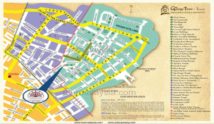
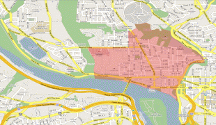
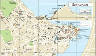
Map - Georgetown (Georgetown)
Map


Country - Guyana
 |
 |
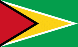
| Flag of Guyana | |
The region known as "the Guianas" consists of the large shield landmass north of the Amazon River and east of the Orinoco River known as the "land of many waters". Nine indigenous tribes reside in Guyana: the Wai Wai, Macushi, Patamona, Lokono, Kalina, Wapishana, Pemon, Akawaio and Warao. Historically dominated by the Lokono and Kalina tribes, Guyana was colonised by the Dutch before coming under British control in the late 18th century. It was governed as British Guiana, with a mostly plantation-style economy until the 1950s. It gained independence in 1966, and officially became a republic within the Commonwealth of Nations in 1970. The legacy of British rule is reflected in the country's political administration and diverse population, which includes Indian, African, Indigenous, Chinese, Portuguese, other European, and various multiracial groups. In 2017, 41% of the population of Guyana lived below the poverty line.
Currency / Language
| ISO | Currency | Symbol | Significant figures |
|---|---|---|---|
| GYD | Guyanese dollar | $ | 2 |
| ISO | Language |
|---|---|
| EN | English language |