Goygol Rayon (Goygol Rayon)
Goygol District (Göygöl rayonu) is one of the 66 districts of Azerbaijan. It is located in the west of the country and belongs to the Ganja-Dashkasan Economic Region. The district borders the districts of Goranboy, Kalbajar, Dashkasan, Shamkir, Samukh, and the city of Ganja. Its capital and largest city is Goygol. As of 2020, the district had a population of 64,600.
Formerly known as Khanlar, the region was renamed "Göygöl" after Lake Göygöl, the famous blue lake, by the decision of the Parliament of Azerbaijan on April 25, 2008.
The administrative centre of the district, Goygol city was established in 1819 by German settlers who came from Kingdom of Württemberg and was called Helenendorf. Houses were built in German style, streets were laid down, a school, a kindergarten and a music school were established. The main building of the current Agrarian Industry Plant was constructed as a winery by the Fohrer brothers who were dealing with wine and cognac production there.
In the area of Goygol district, Narimanov district was established in August 1930 of which centre was Helenendorf. Narimanov district was renamed Khanlar district and its centre Helenendorf was called Khanlar city since November 1938. The territory of the district was divided into 2 districts - Samukh district was created in addition to Khanlar district in February 1992. The names of the district and its centre were changed again in 2008 according to the Presidential Decree dated 7 May 2008 and have been called Goygol district and Goygol city respectively.
Access to the southern portions of the rayon is restricted due to its proximity to Nagorno-Karabakh and the armistice line there.
Map - Goygol Rayon (Goygol Rayon)
Map
Country - Azerbaijan
 |
 |
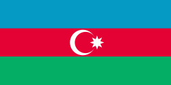
| Flag of Azerbaijan | |
The Azerbaijan Democratic Republic proclaimed its independence from the Transcaucasian Democratic Federative Republic in 1918 and became the first secular democratic Muslim-majority state. In 1920, the country was incorporated into the Soviet Union as the Azerbaijan SSR. The modern Republic of Azerbaijan proclaimed its independence on 30 August 1991, shortly before the dissolution of the Soviet Union in the same year. In September 1991, the ethnic Armenian majority of the Nagorno-Karabakh region formed the self-proclaimed Republic of Artsakh. The region and seven surrounding districts are internationally recognized as part of Azerbaijan pending a solution to the status of the Nagorno-Karabakh through negotiations facilitated by the OSCE, although became de facto independent with the end of the First Nagorno-Karabakh War in 1994. Following the Second Nagorno-Karabakh War in 2020, the seven districts and parts of Nagorno-Karabakh were returned to Azerbaijani control.
Currency / Language
| ISO | Currency | Symbol | Significant figures |
|---|---|---|---|
| AZN | Azerbaijani manat | ₼ | 2 |
| ISO | Language |
|---|---|
| HY | Armenian language |
| AZ | Azerbaijani language |
| RU | Russian language |


