Green Island (Green Island)
Green Island is a small island lying off the eastern coast of Antigua. It is a private island that has been owned by the Mill Reef Club since 1947. It lies close to the mouth of Nonsuch Bay.
Colonel Richard Ayres was granted the lease of Green Island in 1673. By 1731 it was owned by Stephen Blizard, and was still owned by Blizard's heirs in 1790. The heirs of Robert Maginley owned the island in 1921. Maginley and his three brothers were immigrants to Antigua from Ireland and eventually owned 4,500 acres making them the largest landholders on Antigua. A plantation was established on Green Island, very little evidence remains of the sugar mill on Green Island.
Green Island is located off the southeastern peninsula of Antigua, at the southern entrance to Nonsuch Bay. Towards the mainland, the Green Bay, a bay-like strait south of the island, in front of Cape Cork Point, Green Island is only about 350 meters away from Antigua island. Administratively, it belongs to the Saint Phillip Parish.
The island itself measures about two kilometers from west to east; its width varies by two south-facing peninsulas in the range of a few hundred meters (maximum 650 m), forming several sheltered bays. Altogether, the island has an area of about 40ha. A sea-side peninsula ends in the Man of War Point, as the eastern tip of Antigua (as a region, east point of the main island the Neck of Land), from which the Atlantic Ocean extends over nearly 4,000 kilometers to the approximately latitude Cape Verde. The island rises only a few meters above sea level, and is composed of tropical brushwood and partly lined by rock, partly by pure white beaches. On both sides are reefs and rocks in front, the northern reef blocks the entire Nonsuch Bay and extends to Long Bay.
Map - Green Island (Green Island)
Map
Country - Antigua_and_Barbuda
 |
 |
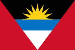
| Flag of Antigua and Barbuda | |
The country consists of two major islands, Antigua and Barbuda, which are approximately 40 km apart, and several smaller islands, including Great Bird, Green, Guiana, Long, Maiden, Prickly Pear, York, and Redonda. The permanent population is approximately 97,120 ( estimates), with 97% residing in Antigua. St. John's, Antigua, is the country's capital, major city, and largest port. Codrington is Barbuda's largest town.
Currency / Language
| ISO | Currency | Symbol | Significant figures |
|---|---|---|---|
| XCD | East Caribbean dollar | $ | 2 |
| ISO | Language |
|---|---|
| EN | English language |


