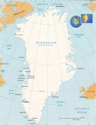
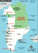
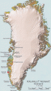
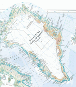
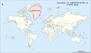
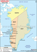
Greenland
 |
 |
Though a part of the continent of North America, Greenland has been politically and culturally associated with Europe (specifically Norway and Denmark, the colonial powers) for more than a millennium, beginning in 986. Greenland has been inhabited at intervals over at least the last 4,500 years by Arctic peoples whose forebears migrated there from what is now Canada. Norsemen settled the uninhabited southern part of Greenland beginning in the 10th century, having previously settled Iceland. Inuit arrived in the 13th century. Though under continuous influence of Norway and Norwegians, Greenland was not formally under the Norwegian crown until 1261. The Norse colonies disappeared in the late 15th century, after Norway was hit by the Black Death and entered a severe decline.
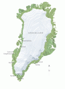
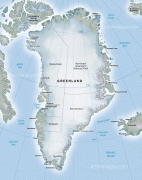
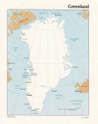
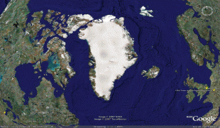
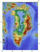
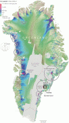
In the early 17th century, Dano-Norwegian explorers reached Greenland again. When Denmark and Norway separated Greenland became Danish in 1814 and was fully integrated in the Danish state in 1953 under the Constitution of Denmark, which made the people in Greenland citizens of Denmark. In 1979, Denmark granted home rule to Greenland; in 2008, Greenlanders voted for the Self-Government Act, which transferred more power from the Danish government to the local Greenlandic government. Under the new structure, Greenland has gradually assumed responsibility for a number of governmental services and areas of competence. The Danish government retains control of citizenship, monetary policy, and foreign affairs, including defence. Most residents of Greenland are Inuit. The population is concentrated mainly on the southwest coast, and the rest of the island is sparsely populated. Three-quarters of Greenland is covered by the only permanent ice sheet outside Antarctica. With a population of 56,081 (2020), Greenland is the least densely populated region in the world. 67% of its electricity production comes from renewable energy, mostly from hydropower.
The early Norse settlers named the island Greenland. In the Icelandic sagas, the Norwegian-born Icelander Erik the Red was exiled from Iceland for manslaughter. With his extended family and his thralls (slaves or serfs), he set out in ships to explore an icy land known to lie to the northwest. After finding a habitable area and settling there, he named it (translated as "Greenland"), supposedly in the hope that the pleasant name would attract settlers. The Saga of Erik the Red states: "In the summer, Erik left to settle in the country he had found, which he called Greenland, as he said people would be attracted there if it had a favorable name."
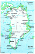
The name of the country in the Greenlandic language is Kalaallit Nunaat ("land of the Kalaallit"). The Kalaallit are the Greenlandic Inuit who inhabit the country's western region.
In World War II, the United States military used Bluie as a code name for Greenland, where they kept several bases named Bluie (East or West) (sequential numeral).