Grey District (Grey District)
The Grey District is on the West Coast of the South Island. It stretches from the south banks of the Punakaiki River in the north, southeast to Mt Anderson, north to The Pinacle, southeast to Craigeburn, in a southeast direction to Mt Barron, southwest to Jacksons and following the Taramakau River to the Tasman Sea.
The district is rich in history and character. Key industries are tourism, mining, agriculture, fishing, manufacturing and services industries. The main hospital for the West Coast is in Greymouth.
Grey District covers 3474.44 km2 and had an estimated population of as of with a population density of people per km2. live in Greymouth and in Runanga.
Grey District had a population of 13,344 at the 2018 New Zealand census, a decrease of 27 people (−0.2%) since the 2013 census, and an increase of 123 people (0.9%) since the 2006 census. There were 5,361 households. There were 6,771 males and 6,573 females, giving a sex ratio of 1.03 males per female. The median age was 43.9 years (compared with 37.4 years nationally), with 2,565 people (19.2%) aged under 15 years, 2,244 (16.8%) aged 15 to 29, 6,093 (45.7%) aged 30 to 64, and 2,445 (18.3%) aged 65 or older.
Ethnicities were 92.2% European/Pākehā, 10.2% Māori, 1.3% Pacific peoples, 2.9% Asian, and 2.0% other ethnicities. People may identify with more than one ethnicity.
The percentage of people born overseas was 10.1, compared with 27.1% nationally.
Although some people objected to giving their religion, 51.7% had no religion, 36.9% were Christian, 0.5% were Hindu, 0.2% were Muslim, 0.2% were Buddhist and 2.0% had other religions.
Of those at least 15 years old, 1,137 (10.5%) people had a bachelor or higher degree, and 2,970 (27.6%) people had no formal qualifications. The median income was $27,700, compared with $31,800 nationally. 1,329 people (12.3%) earned over $70,000 compared to 17.2% nationally. The employment status of those at least 15 was that 5,295 (49.1%) people were employed full-time, 1,665 (15.4%) were part-time, and 372 (3.5%) were unemployed.
Map - Grey District (Grey District)
Map
Country - New_Zealand
 |
 |
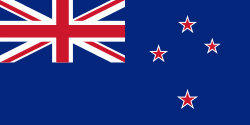
| Flag of New Zealand | |
The islands of New Zealand were the last large habitable land to be settled by humans. Between about 1280 and 1350, Polynesians began to settle in the islands and then developed a distinctive Māori culture. In 1642, the Dutch explorer Abel Tasman became the first European to sight and record New Zealand. In 1840, representatives of the United Kingdom and Māori chiefs signed the Treaty of Waitangi, which in its English version declared British sovereignty over the islands. In 1841, New Zealand became a colony within the British Empire. Subsequently, a series of conflicts between the colonial government and Māori tribes resulted in the alienation and confiscation of large amounts of Māori land. New Zealand became a dominion in 1907; it gained full statutory independence in 1947, retaining the monarch as head of state. Today, the majority of New Zealand's population of 5.1 million is of European descent; the indigenous Māori are the largest minority, followed by Asians and Pacific Islanders. Reflecting this, New Zealand's culture is mainly derived from Māori and early British settlers, with recent broadening of culture arising from increased immigration. The official languages are English, Māori, and New Zealand Sign Language, with the local dialect of English being dominant.
Currency / Language
| ISO | Currency | Symbol | Significant figures |
|---|---|---|---|
| NZD | New Zealand dollar | $ | 2 |
| ISO | Language |
|---|---|
| EN | English language |


