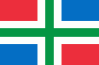
Groningen (Provincie Groningen)
 |
 |
Historically the area was at different times part of Frisia, the Frankish Empire, the Holy Roman Empire, and the Dutch Republic, the precursor state of the modern Netherlands. In the 14th century, the city of Groningen became a member of the Hanseatic League.
The provincial capital and the largest city in the province is the city of Groningen (231,299 inhabitants ). Since 2016, René Paas has been the King's Commissioner in the province. A coalition of GroenLinks, the Labour Party, ChristianUnion, People's Party for Freedom and Democracy, Democrats 66, and Christian Democratic Appeal forms the executive branch. The province is divided into 10 municipalities.
The land is mainly used for agriculture. There are seaports in Delfzijl and Eemshaven. The Groningen gas field, one of the world's largest, was discovered in 1959. The province is home to the University of Groningen and Hanze University of Applied Sciences.
Groningen was originally a part of Frisia. It became a part of the Frankish Empire around 785. Charlemagne assigned the Christianization of this new possession to Ludger.
In the 11th century, the city of Groningen was a village in Drenthe that belonged to the Bishopric of Utrecht, while most of the province was in the Prince-Bishopric of Münster.
During the Middle Ages, central control was remote, and the city of Groningen acted as a city-state, exerting a dominating influence on the surrounding Ommelanden. In the 14th century, Groningen became one of the towns within the Hanseatic League. In the years after, Groningen expanded its influence. At its peak almost all of the current province Friesland was under the influence and control of Groningen.
Shortly before 1498, Maximilian I, Holy Roman Emperor gave Groningen and Friesland to Albert III, Duke of Saxony, who could however not establish permanent control. In 1514/15 Groningen came to the Duchy of Guelders, and in 1536 as the Lordship of Groningen to the Habsburg Netherlands.
In 1594, Groningen was conquered from the Spanish by the Republic of the Seven United Provinces, precursor state of the Netherlands, to which it belonged henceforth.
During World War II, the Netherlands were occupied by Nazi Germany. In April 1945, the 2nd Canadian Division fought in the Battle of Groningen, which resulted in the liberation of the city and in the death of 130, the capture of 5,212, and the fleeing of 2,000 German soldiers. In May 1945, another 3,000 German soldiers were captured in the Battle of Delfzijl by the 5th Canadian Division, after which all of the northern provinces were liberated.
Map - Groningen (Provincie Groningen)
Map


Country - Netherlands
 |
 |
The four largest cities in the Netherlands are Amsterdam, Rotterdam, The Hague and Utrecht. Amsterdam is the country's most populous city and the nominal capital. The Hague holds the seat of the States General, Cabinet and Supreme Court. The Port of Rotterdam is the busiest seaport in Europe. Schiphol is the busiest airport in the Netherlands, and the third busiest in Europe. The Netherlands is a founding member of the European Union, Eurozone, G10, NATO, OECD, and WTO, as well as a part of the Schengen Area and the trilateral Benelux Union. It hosts several intergovernmental organisations and international courts, many of which are centred in The Hague.
Currency / Language
| ISO | Currency | Symbol | Significant figures |
|---|---|---|---|
| EUR | Euro | € | 2 |
| ISO | Language |
|---|---|
| NL | Dutch language |
| FY | West Frisian language |


