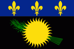
Guadeloupe (Gwadloup, ) is an archipelago and overseas department and region of France in the Caribbean. It consists of four inhabited islands—Basse-Terre, Grande-Terre, Marie-Galante, La Désirade, and the two inhabited Îles des Saintes—as well as many uninhabited islands and outcroppings. It is south of Antigua and Barbuda and Montserrat, north of the Commonwealth of Dominica. The region's capital city is Basse-Terre, located on the southern west coast of Basse-Terre Island; however, the most populous city is Les Abymes and the main centre of business is neighbouring Pointe-à-Pitre, both located on Grande-Terre Island. It had a population of 384,239 in 2019.
Like the other overseas departments, it is an integral part of France. As a constituent territory of the European Union and the Eurozone, the euro is its official currency and any European Union citizen is free to settle and work there indefinitely. However, as an overseas department, it is not part of the Schengen Area. The region formerly included Saint Barthélemy and Saint Martin, which were detached from Guadeloupe in 2007 following a 2003 referendum.


