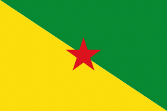
French Guiana ( or ; Guyane ; Lagwiyann ) is an overseas department of France located on the northern coast of South America in the Guianas. Bordered by Suriname to the west and Brazil to the east and south, French Guiana covers a land area of 83534 km2, and is inhabited by 301,099 people.
French Guiana is the second-largest region of France (more than one-seventh the size of Metropolitan France) and the largest outermost region within the European Union. It has a very low population density, with only 3.6 PD/sqkm. (Its population is less than 1⁄200 that of Metropolitan France.) Half of its 301,099 inhabitants in 2023 lived in the metropolitan area of Cayenne, its capital. 98.9% of the land territory of French Guiana is covered by forests, a large part of which is primeval rainforest. The Guiana Amazonian Park, which is the largest national park in the European Union, covers 41% of French Guiana's territory.


