Gyeonggi-do
 |
 |
Gyeonggi-do has been a politically important area since 18 BCE, when Korea was divided into three nations during the Three Kingdoms period. Ever since King Onjo, the founder of Baekje (one of the three kingdoms), founded the government in Wiryeseong of Hanam, the Han River Valley was absorbed into Goguryeo in the mid-fifth century, and became Silla's territory in the year 553 (the 14th year of King Jinheung). Afterward, the current location of Gyeonggi-do, one of the nine states of Later Silla, was called Hansanju.
The Gyeonggi region started to rise as the central region of Goryeo as King Taejo of Goryeo (the kingdom following Silla) set up the capital in Gaesong. Since 1018 (the 9th year of Goryeo's King Hyeonjong), this area has been officially called "Gyeonggi".
During the Joseon, which was founded after the Goryeo, King Taejo of Joseon set the capital in Hanyang, while restructuring Gyeonggi's area to include Gwangju, Suwon, Yeoju, and Anseong, along with the southeast region. Since the period of King Taejong and Sejong the Great, the Gyeonggi region has been very similar to the current administrative area of Gyeonggi-do.
In 1895 the 23-Bu system, which reorganized administrative areas, was effected. The Gyeonggi region was divided into Hanseong (modern Seoul; Hanseong-bu; 한성부; 漢城府), Incheon (Incheon-bu; 인천부; 仁川府), Chungju (Chungju-bu; 충주부; 忠州府), Gongju (Gongju-bu; 공주부; 公州府), and Kaesong (Kaesong-bu; 개성부; 開城府).
During the Japanese colonial period, Hanseong-bu was incorporated into Gyeonggi-do. On October 1, 1910, it was renamed Keijo and a provincial government was placed in Keijo according to the reorganization of administrative districts.
After liberation and the foundation of two separate Korean states, Gyeonggi-do and its capital, Seoul, were separated with partial regions of Gyeonggi-do being incorporated into Seoul thereafter in 1946. Additionally, Kaesong became North Korean territory, the only city to change control after the countries were divided at the 38th parallel, which is now part of North Korea's North Hwanghae Province.
In 1967 the seat of the Gyeonggi provincial government was transferred from Seoul to Suwon. After Incheon separated from Gyeonggi-do in 1981, Gyeonggi regions such as Ongjin County and Ganghwa County were incorporated into Incheon in 1995.
Map - Gyeonggi-do
Map


Country - South_Korea
 |
 |
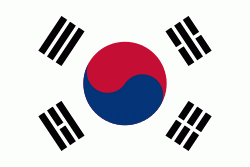
| Flag of South Korea | |
The Korean Peninsula was inhabited as early as the Lower Paleolithic period. Its first kingdom was noted in Chinese records in the early 7th century BCE. Following the unification of the Three Kingdoms of Korea into Silla and Balhae in the late 7th century, Korea was ruled by the Goryeo dynasty (918–1392) and the Joseon dynasty (1392–1897). The succeeding Korean Empire (1897–1910) was annexed in 1910 into the Empire of Japan. Japanese rule ended following Japan's surrender in World War II, after which Korea was divided into two zones; a northern zone occupied by the Soviet Union and a southern zone occupied by the United States. After negotiations on reunification failed, the southern zone became the Republic of Korea in August 1948 while the northern zone became the communist Democratic People's Republic of Korea the following month.
Currency / Language
| ISO | Currency | Symbol | Significant figures |
|---|---|---|---|
| KRW | South Korean won | â‚© | 0 |
| ISO | Language |
|---|---|
| EN | English language |
| KO | Korean language |


