Gyumri
 |
The city underwent a tumultuous period during and after World War 1. While Russian forces withdrew from the South Caucasus due to the October Revolution, the city became host to large numbers of Armenian refugees fleeing the Armenian Genocide, in particular hosting 22,000 orphaned children in around 170 orphanage buildings. It was renamed to Leninakan during the Soviet period and became a major industrial and textile center in Soviet Armenia. The city's population rapidly grew to above 200,000 prior to the 1988 Spitak earthquake, when it was devastated, with the city's population being reduced to 121,976 as of the 2011 census. The city was renamed to Gyumri under modern independent Armenia soon after the breakup of the Soviet Union, and post-earthquake reconstruction efforts have continued in the city to this day.
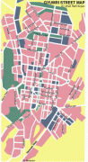
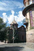
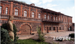
Today, Gyumri continues to grapple with the lasting effects of the 1988 earthquake, but remains known as the cultural hub of Armenia due to the many artists and craftsman who originated from the city. The city is also in particular notable for the large Kumayri historic district that managed to mostly survive the 1988 earthquake, dating back mainly to the 19th century and being one of the few surviving places in the world with authentic urban Armenian architecture.
The area of modern-day Gyumri was originally known as Kumayri during the period of the Kingdom of Urartu. Over time, the name became disrupted through phonetic changes to Kumri, then Gumri, and finally Gyumri. In 1837, Gyumri was renamed Alexandropol after Czar Nicholas I's wife, Princess Alexandra Fyodorovna. Between 1924 and 1990, the city was known as Leninakan in honor of Vladimir Lenin. Following independence, the original name Kumayri was used until 1992, when Gyumri was chosen as the name of the city.
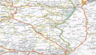
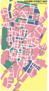
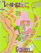
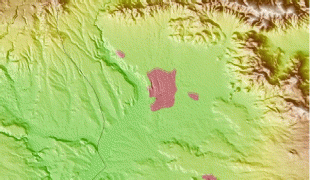
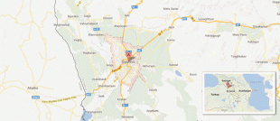
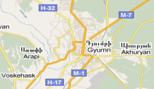
Map - Gyumri
Map


Country - Armenia
 |
 |
| Flag of Armenia | |
Armenia is a unitary, multi-party, democratic nation-state with an ancient cultural heritage. The first Armenian state of Urartu was established in 860 BC, and by the 6th century BC it was replaced by the Satrapy of Armenia. The Kingdom of Armenia reached its height under Tigranes the Great in the 1st century BC and in the year 301 became the first state in the world to adopt Christianity as its official religion. The ancient Armenian kingdom was split between the Byzantine and Sasanian Empires around the early 5th century. Under the Bagratuni dynasty, the Bagratid Kingdom of Armenia was restored in the 9th century. Declining due to the wars against the Byzantines, the kingdom fell in 1045 and Armenia was soon after invaded by the Seljuk Turks. An Armenian principality and later a kingdom Cilician Armenia was located on the coast of the Mediterranean Sea between the 11th and 14th centuries.
Currency / Language
| ISO | Currency | Symbol | Significant figures |
|---|---|---|---|
| AMD | Armenian dram | Ö | 2 |
| ISO | Language |
|---|---|
| HY | Armenian language |