Haa District (Haa Dzongkhag)
Haa District (Dzongkha: ཧཱ་; Wylie: Haa; alternative spellings include "Ha") is one of the 20 dzongkhag or districts comprising Bhutan. An alternative name for the district is "Hidden-Land Rice Valley." It the second least-populated dzongkhag in the country after Gasa.
The most-spoken language of the district is Dzongkha.
The river Haa Chhu, originating at Jomolhari mountain, flows through the district.
The name Haa (pronounced "hah"), as well as the more ancient name Has (Dzongkha: ཧས་; Wylie: Has; pronounced "hay"), connotes esoteric hiddenness. Haa's major feature is the Haa Valley, a steep north-south valley with a narrow floor. The district is presided over by three mountains collectively referred as "Three Brothers" -- Jampelyang, Chana-Dorji, and Chenrezig.
Map - Haa District (Haa Dzongkhag)
Map


Country - Bhutan
 |
 |
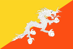
| Flag of Bhutan | |
The subalpine Himalayan mountains in the north rise from the country's lush subtropical plains in the south. In the Bhutanese Himalayas, there are peaks higher than 7000 m above sea level. Gangkhar Puensum is Bhutan's highest peak and is the highest unclimbed mountain in the world. The wildlife of Bhutan is notable for its diversity, including the Himalayan takin and golden langur. The capital and largest city is Thimphu, holding close to 1/7th of the population.
Currency / Language
| ISO | Currency | Symbol | Significant figures |
|---|---|---|---|
| BTN | Bhutanese ngultrum | Nu | 2 |
| INR | Indian rupee | ₹ | 2 |
| ISO | Language |
|---|---|
| DZ | Dzongkha language |