Il-Belt Valletta (Valletta)
 |
 |
Valletta's 16th-century buildings were constructed by the Knights Hospitaller. The city was named after Jean Parisot de Valette, who succeeded in defending the island from an Ottoman invasion during the Great Siege of Malta. The city is Baroque in character, with elements of Mannerist, Neo-Classical and Modern architecture, though the Second World War left major scars on the city, particularly the destruction of the Royal Opera House. The city was officially recognised as a World Heritage Site by UNESCO in 1980. The city has 320 monuments, all within an area of 0.55 square kilometres (0.21 sq mi), making it one of the most concentrated historic areas in the world. Sometimes called an "open-air museum", Valletta was chosen as the European Capital of Culture in 2018. Valletta is also the sunniest city in Europe.
The city is noted for its fortifications, consisting of bastions, curtains and cavaliers, along with the beauty of its Baroque palaces, gardens and churches.
The peninsula was previously called Xagħret Mewwija (Mu' awiya – Meuia; named during the Arab period ) or Ħal Newwija. Mewwija refers to a sheltered place. Some authors state that the extreme end of the peninsula was known as Xebb ir-Ras (Sheb point), of which name origins from the lighthouse on site. A family which surely owned land became known as Sceberras, now a Maltese surname as Sciberras. At one point the entire peninsula became known as Sceberras.
Recent scholarly studies have however shown that the Xeberras phrase is of Punic origin and means 'the headland' and 'the middle peninsula' as it actually is.
Map - Il-Belt Valletta (Valletta)
Map


Country - Malta
 |
 |
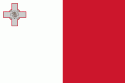
| Flag of Malta | |
Malta has been inhabited since approximately 5900 BC. Its location in the centre of the Mediterranean has historically given it great strategic importance as a naval base, with a succession of powers having contested and ruled the islands, including the Phoenicians and Carthaginians, Romans, Greeks, Arabs, Normans, Aragonese, Knights of St. John, French, and British, amongst others.
Currency / Language
| ISO | Currency | Symbol | Significant figures |
|---|---|---|---|
| EUR | Euro | € | 2 |
| ISO | Language |
|---|---|
| EN | English language |
| MT | Maltese language |
