Map - Ishikawa Prefecture (Ishikawa-ken)

Ishikawa Prefecture (Ishikawa-ken)
Ishikawa Prefecture (石川県) is a prefecture of Japan located in the Chūbu region of Honshu island. Ishikawa Prefecture has a population of 1,140,573 (31 October 2019) and has a geographic area of 4,186 km2 (1,616 sq mi). Ishikawa Prefecture borders Toyama Prefecture to the east, Gifu Prefecture to the southeast, and Fukui Prefecture to the south.

Kanazawa is the capital and largest city of Ishikawa Prefecture, with other major cities including Hakusan, Komatsu, and Kaga. Ishikawa is located on the Sea of Japan coast and features the most of the Noto Peninsula which forms Toyama Bay, one of the largest bays in Japan. Ishikawa Prefecture is part of the historic Hokuriku region and formerly an important populated center that contained some of the wealthiest han (domains) of the Japanese feudal era. Ishikawa Prefecture is home to Kanazawa Castle, Kenroku-en one of the Three Great Gardens of Japan, Nyotaimori ("body sushi"), and Kutani ware.

Ishikawa was formed in 1872 from the merger of Kaga Province and the smaller Noto Province.

 
Map - Ishikawa Prefecture (Ishikawa-ken)
Map
Map-japan-prefecture...
2084x2504
images.wikia.com
Japan_Ishikawa_large...
1397x1593
static2.wikia.nocook...
photo3.jpg
956x1280
ishikawajet.files.wo...
depositphotos_121973...
1023x915
st.depositphotos.com
Wajima_in_Ishikawa_P...
981x901
upload.wikimedia.org
Uchinada_in_Ishikawa...
981x901
upload.wikimedia.org
Tsubata_in_Ishikawa_...
981x901
upload.wikimedia.org
Kaga_in_Ishikawa_Pre...
981x901
upload.wikimedia.org
Nanao_in_Ishikawa_Pr...
981x901
upload.wikimedia.org
map.jpg
861x945
ishikawajet.files.wo...
hakusan_super_rindo....
667x1000
www.ishikawa-kaga-ha...
b_17_ishikawa_800p.g...
800x800
www.sekaichizu.jp
kmap.gif
730x780
www.kanazawa-hakusan...
google%252B1.jpg
1022x555
2.bp.blogspot.com
japan-kanazawa-stamp...
700x641
janalicious.files.wo...
map2.gif
720x540
www.kunaicho.go.jp
4275_map_02.gif
590x650
www.japan-guide.com
17ishikawa.png
600x600
kakkuwa.sakura.ne.jp
map_17.gif
580x551
www.mapfan.com
main.jpg
472x650
www.mlit.go.jp
Country - Japan
Flag of Japan
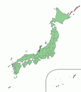
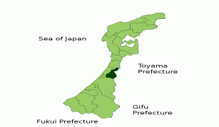
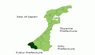
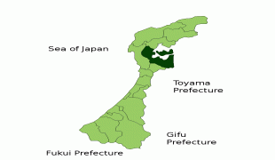
Japan (日本, or, and formally 日本国, Nihonkoku) is an island country in East Asia. It is situated in the northwest Pacific Ocean and is bordered on the west by the Sea of Japan, extending from the Sea of Okhotsk in the north toward the East China Sea, Philippine Sea, and Taiwan in the south. Japan is a part of the Ring of Fire, and spans an archipelago of 6852 islands covering 377,975 km2; the five main islands are Hokkaido, Honshu (the "mainland"), Shikoku, Kyushu, and Okinawa. Tokyo is the nation's capital and largest city, followed by Yokohama, Osaka, Nagoya, Sapporo, Fukuoka, Kobe, and Kyoto.

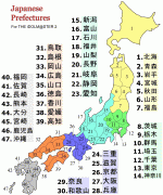
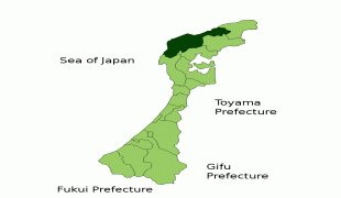
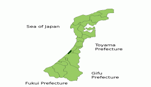
Japan is the eleventh most populous country in the world, as well as one of the most densely populated and urbanized. About three-fourths of the country's terrain is mountainous, concentrating its population of 124.8 million on narrow coastal plains. Japan is divided into 47 administrative prefectures and eight traditional regions. The Greater Tokyo Area is the most populous metropolitan area in the world, with more than 37.2 million residents.
Currency / Language  
ISO Currency Symbol Significant figures
JPY Japanese yen ¥ 0
ISO Language
JA Japanese language
Neighbourhood - Country  
Airport