Isla de la Juventud (Municipio Especial Isla de la Juventud)
The largest of the 350 islands in the Canarreos Archipelago (Archipiélago de los Canarreos), the island has an estimated population of 83,544 (in 2019). The capital and largest city is Nueva Gerona in the north, and the second largest and oldest city is Santa Fe in the interior. Other communities include Columbia, La Demajagua (formerly Santa Bárbara), Mac Kinley, Cuchilla Alta, Punta del Este, Sierra de Caballos and Sierra de Casas.
Little is known of the pre-Columbian history of the island, though a cave complex near the Punta del Este beach preserves 235 ancient drawings made by the native population. The island was first sighted by Europeans in 1494 during Christopher Columbus's second voyage to the New World.
Columbus named the island La Evangelista, claiming it for Spain. The island was also known, at various points in its history, as Isla de Cotorras (Isle of Parrots) and Isla de Tesoros (Treasure Island).
Pirate activity in and around the area left its trace in English literature; notably, Treasure Island by Robert Louis Stevenson, and Peter Pan by J. M. Barrie, each drawing on accounts of the island and its native and pirate inhabitants, by reflecting the long dugout canoes that both pirates and the indigenous peoples used, and the American crocodile (Crocodylus acutus).
Following its defeat in the Spanish–American War and the Cuban War of Independence, Spain dropped all claims to Cuba under the terms of the 1898 Treaty of Paris. The Platt Amendment of 1901, which defined Cuba's boundaries for the purposes of U.S. authorities, left the U.S. position on sovereignty over the then Isla de Pinos undetermined. This led to competing claims to the island by the United States and Cuba. In 1907, the U.S. Supreme Court decided, in Pearcy v. Stranahan, that control of the island was a political decision, not a judicial one. In 1916, a pamphlet titled Isle of Pines: American or What? called for the U.S. to annex or purchase the island to settle the issue.
In 1904, Cuba and the United States negotiated and signed the Hay-Quesada Treaty, which recognized Cuba's sovereignty over the island. The U.S. Senate ratified this agreement on March 13, 1925, over the objections of some four hundred United States citizens and companies, who owned or controlled about 95% of the island's land.
Prior to 1976, the island was part of La Habana Province. With the political and administrative reorganization of Cuban provinces in 1976, the island was given the status of "special municipality".
Fidel Castro presided at a ceremony changing the name of the island from Isla de Pinos to Isla de la Juventud on 3 August 1978. This was the realization of a promise that he had made in 1967, when he said "Let’s call it the Isle of Youth when the youth have done something grand with their work here, when they have revolutionized the natural environment, when they see the fruits of their labor and have revolutionized society here."
Map - Isla de la Juventud (Municipio Especial Isla de la Juventud)
Map
Country - Cuba
 |
 |
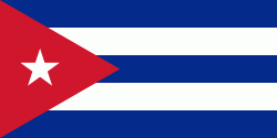
| Flag of Cuba | |
The territory that is now Cuba was inhabited by the Ciboney people from the 4th millennium BC with the Guanahatabey and Taíno peoples until Spanish colonization in the 15th century. From the 15th century, it was a colony of Spain, and slavery was abolished in 1886, remaining a Spanish colony until the Spanish–American War of 1898, when Cuba was occupied by the United States and gained independence in 1902. In 1940, Cuba implemented a new constitution, but mounting political unrest culminated in a coup in 1952 and the subsequent dictatorship of Fulgencio Batista, which was later overthrown in January 1959 by the 26th of July Movement during the Cuban Revolution, which afterwards established communist rule under the leadership of Fidel Castro. The country was a point of contention during the Cold War between the Soviet Union and the United States, and a nuclear war nearly broke out during the Cuban Missile Crisis of 1962. Following the collapse of the Soviet Union, Cuba faced a severe economic downturn in the 1990s, known as the Special Period. In 2008, Fidel Castro resigned after 49 years of leadership of Cuba and was replaced by his brother Raúl Castro.
Currency / Language
| ISO | Currency | Symbol | Significant figures |
|---|---|---|---|
| CUC | Cuban convertible peso | $ | 2 |
| CUP | Cuban peso | $ | 2 |
| ISO | Language |
|---|---|
| ES | Spanish language |


