Map - Ismailia Governorate (Ismailia Governorate)

Ismailia Governorate (Ismailia Governorate)
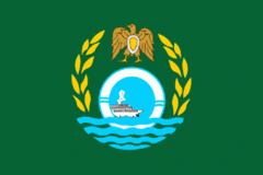
Ismailia Governorate is one of the Canal Zone governorates of Egypt. Located in the northeastern part of the country, its capital is the city of Ismailia. It was named after Ismail Pasha, who as Ottoman Viceroy of Egypt, oversaw the country during the building of the Suez Canal. It is located between the other two Canal governorates; Port Said Governorate, in the Northern part of Egypt and Suez Governorate.

The governorate is divided into municipal divisions, with a total estimated population as of July 2017 of 1,309,474. In the case of Ismailia governorate, there are 4 kism, 5 markaz and 1 new city.

The divisions are generally seven: Ismailia which is the capital, Tell El Kebir, Abu Suwir, Qassasin, Fayid, Qantara West and Qantara East.

 
Map - Ismailia Governorate (Ismailia Governorate)
Country - United_Arab_Republic
Flag of Egypt
The United Arab Republic (UAR; الجمهورية العربية المتحدة), or simply the Arab Republic or Arabia, was a sovereign state in the Middle East from 1958 until 1971. It was initially a political union between Egypt (including the occupied Gaza Strip) and Syria from 1958 until Syria seceded from the union after the 1961 Syrian coup d'état. Egypt continued to be known officially as the United Arab Republic until 1971.

The republic was led by Egyptian President Gamal Abdel Nasser. The UAR was a member of the United Arab States, a loose confederation with the Mutawakkilite Kingdom of Yemen, which was dissolved in 1961.
Currency / Language  
ISO Currency Symbol Significant figures
EGP Egyptian pound £ or جم 2
Neighbourhood - Country  
  •  Libya 
  •  Sudan 
  •  Israel 
Administrative Subdivision
Country, State, Region,...
City, Village,...