Map - Iwate Prefecture (Iwate)

Iwate Prefecture (Iwate)
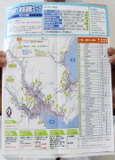
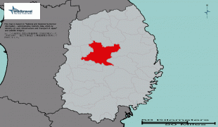
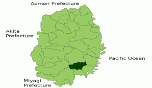
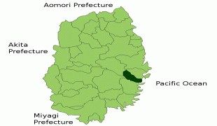
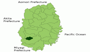
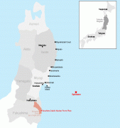
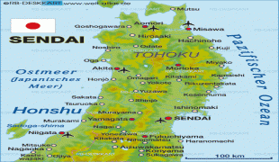
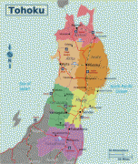
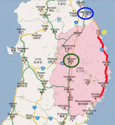
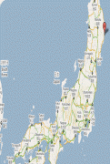
Iwate Prefecture (岩手県) is a prefecture of Japan located in the Tōhoku region of Honshu. It is the second-largest Japanese prefecture at 15,275 km2, with a population of 1,210,534 (as of October 1, 2020). Iwate Prefecture borders Aomori Prefecture to the north, Akita Prefecture to the west, and Miyagi Prefecture to the south.

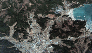
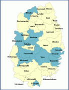
Morioka is the capital and largest city of Iwate Prefecture; other major cities include Ichinoseki, Ōshū, and Hanamaki. Located on Japan's Pacific Ocean coast, Iwate Prefecture features the easternmost point of Honshu at Cape Todo, and shares the highest peaks of the Ōu Mountains—the longest mountain range in Japan—at the border with Akita Prefecture. Iwate Prefecture is home to famous attractions such as Morioka Castle, the Buddhist temples of Hiraizumi including Chūson-ji and Mōtsū-ji, the Fujiwara no Sato movie lot and theme park in Ōshū, and the Tenshochi park in Kitakami known for its huge, ancient cherry trees. Iwate has the lowest population density of any prefecture outside Hokkaido, 5% of its total land area having been designated as National Parks.

There are several theories about the origin of the name "Iwate", but the most well known is the tale Oni no tegata, which is associated with the Mitsuishi or "Three Rocks" Shrine in Morioka. These rocks are said to have been thrown down into Morioka by an eruption of Mt. Iwate. According to the legend, there was once a devil who often tormented and harassed the local people. When the people prayed to the spirits of Mitsuishi for protection, the devil was immediately shackled to these rocks and forced to make a promise never to trouble the people again. As a seal of his oath, the devil made a handprint on one of the rocks, thus giving rise to the name Iwate, its direct translation being "rock hand". Even now after a rainfall, it is said that the devil's hand print can still be seen there.

 
Map - Iwate Prefecture (Iwate)
Map
Openstreetmap - Map - Iwate Prefecture
Openstreetmap
n-otsuchi-a-20140710...
1745x2420
jto.s3.amazonaws.com
JP_Iwate_Prefecture_...
1496x1108
wikitravel.org
Mizusawa_MizusawaSta...
1333x987
www.miz.nao.ac.jp
ryori.jpg
1304x987
walrus.wr.usgs.gov
tohoku_map.jpg
612x1330
www.ando-screen.co.j...
Sumita_in_Iwate_Pref...
981x801
upload.wikimedia.org
Otsuchi_in_Iwate_Pre...
981x801
upload.wikimedia.org
radiation-japan-east...
624x822
www.joewein.net
iwate.gif
792x633
www.misawajapan.com
TohokuMapBig.png
676x684
www.asiamattersforam...
734px-Kanegasaki_in_...
734x599
upload.wikimedia.org
RT-map.png
605x671
www.jetaausa.com
map_tohoku_1304.gif
610x650
www.japan-guide.com
tohoku%252Bcities.gi...
650x520
1.bp.blogspot.com
64982-map.png
680x481
img.static.reliefweb...
507px-Japan_Tohoku_M...
507x599
wikitravel.org
IwateMapCities.gif
475x517
japan.resiliencesyst...
IwateMapCities.gif
475x517
4.bp.blogspot.com
Japan-Map-showing-lo...
400x597
sokids.org
iwatemap.gif
424x559
web-japan.org
Country - Japan
Flag of Japan
Japan (日本, or, and formally 日本国, Nihonkoku) is an island country in East Asia. It is situated in the northwest Pacific Ocean and is bordered on the west by the Sea of Japan, extending from the Sea of Okhotsk in the north toward the East China Sea, Philippine Sea, and Taiwan in the south. Japan is a part of the Ring of Fire, and spans an archipelago of 6852 islands covering 377,975 km2; the five main islands are Hokkaido, Honshu (the "mainland"), Shikoku, Kyushu, and Okinawa. Tokyo is the nation's capital and largest city, followed by Yokohama, Osaka, Nagoya, Sapporo, Fukuoka, Kobe, and Kyoto.

Japan is the eleventh most populous country in the world, as well as one of the most densely populated and urbanized. About three-fourths of the country's terrain is mountainous, concentrating its population of 124.8 million on narrow coastal plains. Japan is divided into 47 administrative prefectures and eight traditional regions. The Greater Tokyo Area is the most populous metropolitan area in the world, with more than 37.2 million residents.
Currency / Language  
ISO Currency Symbol Significant figures
JPY Japanese yen ¥ 0
ISO Language
JA Japanese language
Neighbourhood - Country