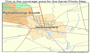
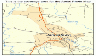
Jamestown (Jamestown)
The city briefly hosted Napoleon in 1815 during his exile on St. Helena and later served as a base for the Royal Navy's efforts to suppress the slave trade. It had no role during the First World War and only played a minor role during the Second World War.
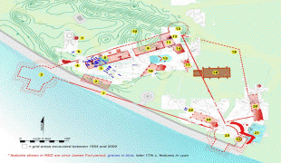
Jamestown was founded in 1659 by the East India Company and is named after James, Duke of York, the future King James II of England. A fort, originally named the Castle of St John, was quickly built and, with the restoration of the monarchy in 1660, the fort was renamed James Fort, the town Jamestown and the valley James Valley. The fort and associated gun batteries dominated James Bay and were sporadically improved over the years. In January 1673 the Dutch East India Company briefly seized control of the island until the English East India Company recaptured it in May. Since then the town has been continuously inhabited under English and then British rule.
After his defeat in the Battle of Waterloo in June 1815 and the subsequent occupation of Paris, the Emperor of the French, Napoleon, surrendered to the British and was exiled to St Helena. He arrived on 21 October aboard the 74-gun ship HMS Bellerophon (1786) and resided at the Briars in Jamestown for several months until he was transferred to Longwood House in a more remote part of the island in December. Jamestown was chosen to host a vice admiralty court and a naval base for British efforts to interdict the slave traffic between Africa and the Americas. Captured slave ships were often brought to Jamestown to be sold and their cargos were off-loaded in Rupert's Valley. By the time that the naval station was closed in the 1870s, an estimated 25,000 slaves had been rescued, although about 5,000 died shortly after arrival and were buried in Rupert's Valley. Long lost, their graves were rediscovered in 2006 in conjunction with preliminary digging for the airport. A team of archaeologists arrived in mid-2008 to excavate the graves. Some of the finds from the excavations are on exhibit at the International Slavery Museum in Liverpool, England.
The island was too isolated to play any role in the First World War and only played a minimal one during the Second World War. The oil tanker RFA Darkdale was sunk by the GS U-68 (1940) in James Bay on 22 October 1941 with only nine of the 50-man crew surviving. She had been sent to St Helena a few months earlier to refuel ships operating in the South Atlantic. The wreck leaked small amounts of oil until its gradual deterioration caused the Ministry of Defence to send a team of divers to pump out all the remaining oil in June 2015.
Map - Jamestown (Jamestown)
Map


Country - St_Helena,_Ascension_and_Tristan_da_Cunha
 |
 |
Of volcanic origin, the islands of Saint Helena, Ascension Island, and Tristan da Cunha were all formerly separate colonies of the English crown, though separately discovered by several Portuguese explorers between 1502 and 1504.
Currency / Language
| ISO | Language |
|---|---|
| EN | English language |